Val d'Ayas

Champoluc

BLUE LAKE - long tour

CHAMPOLUC - CREST - RESY - PIAN DI VERRA INFERIORE - BLUE LAKE - ST. JACQUES

By: Comune di Ayas

Route category: Trekking

Duration: 5 hours 10 minutes

Length: 12000 m

Difficulty: Medium

Lago Blu e vallata

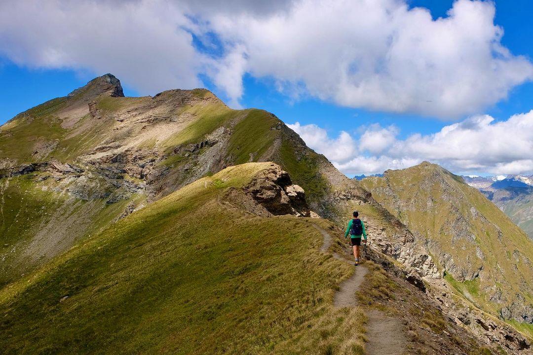
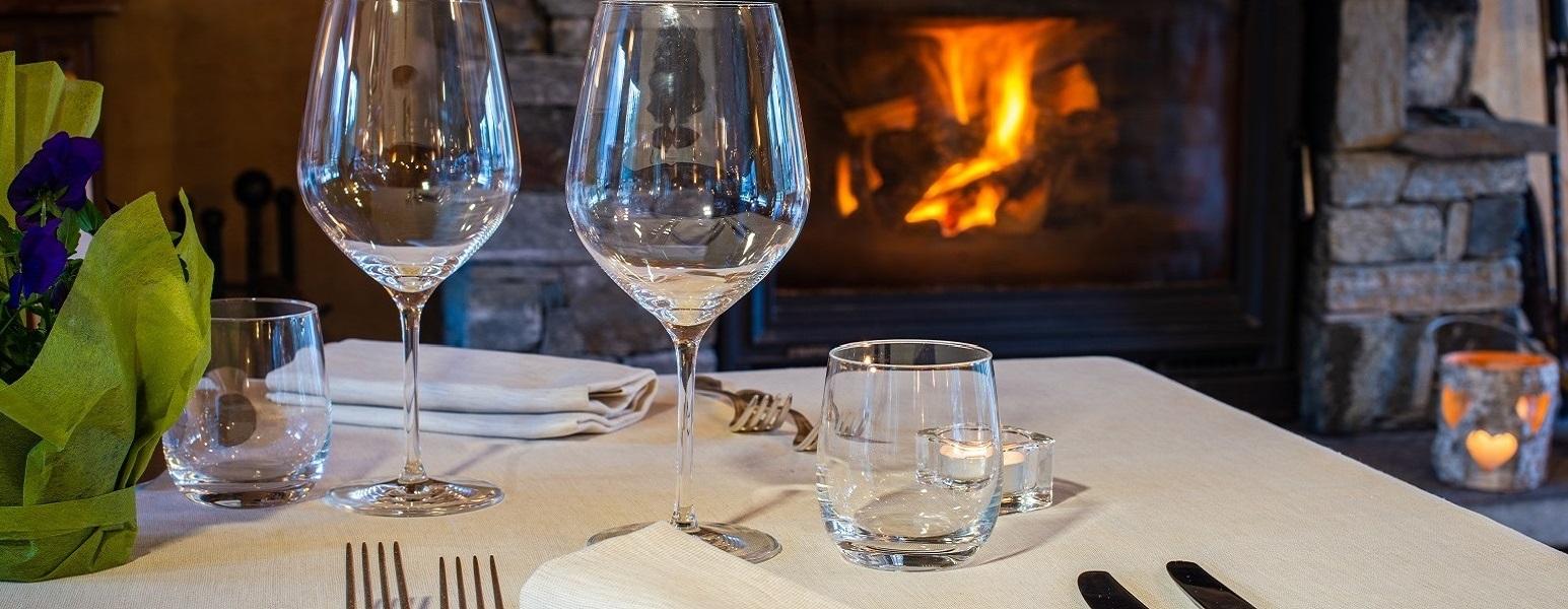
This first itinerary represents a moderately long but not strenuous walk (there is also a shorter version starting from St. Jacques des Allemands);

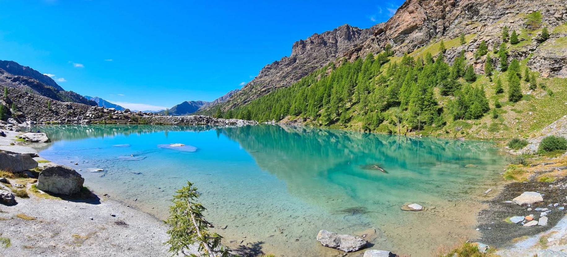
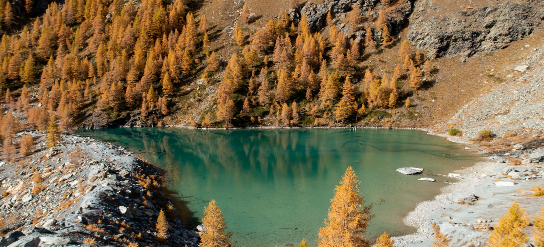
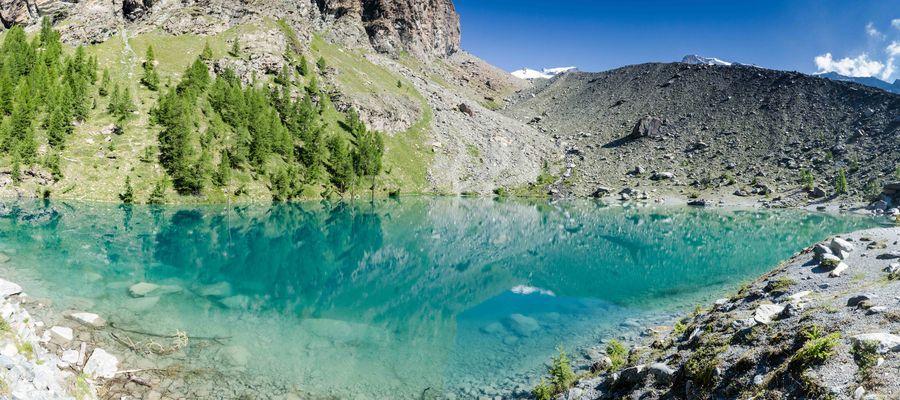
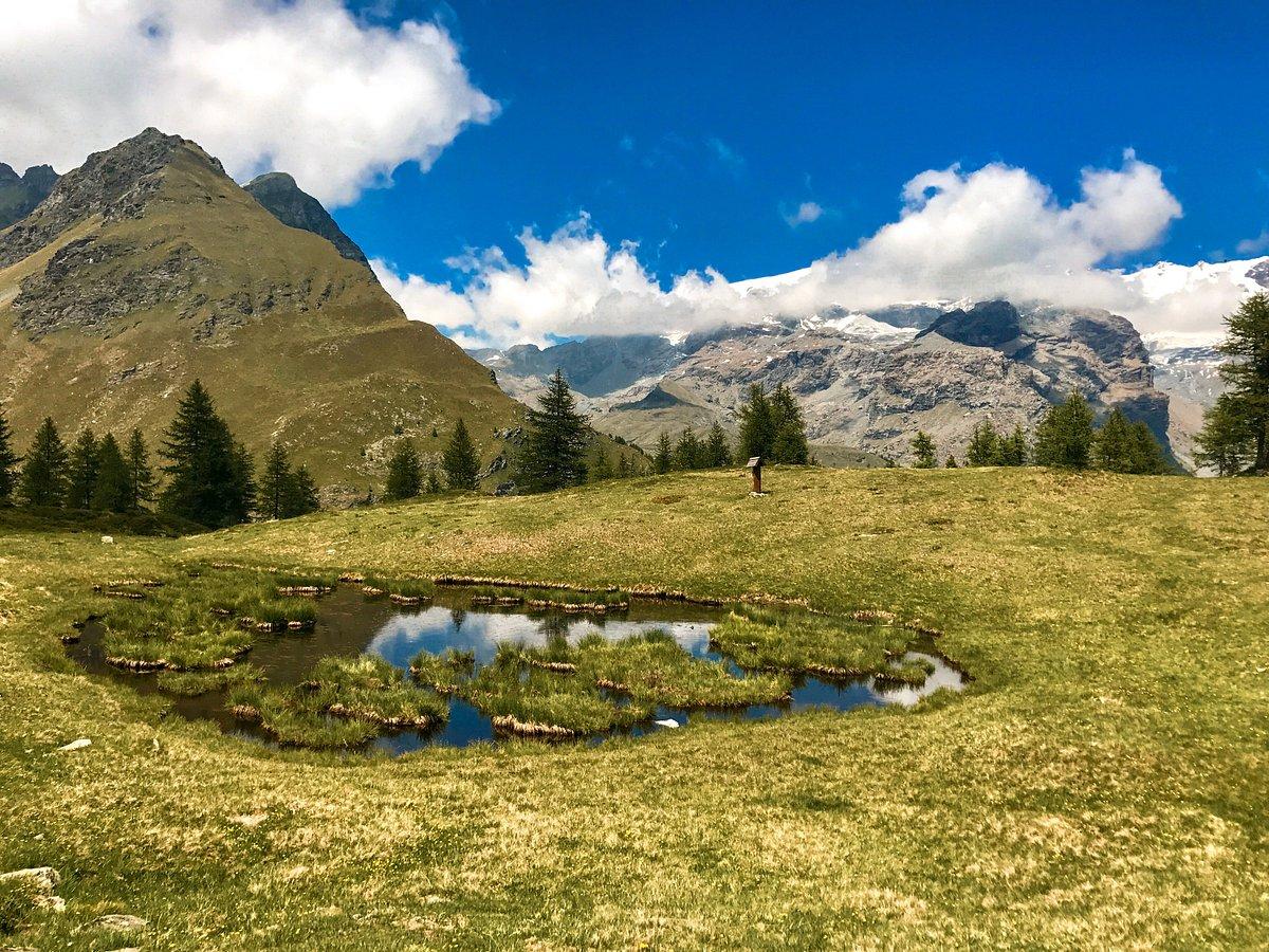
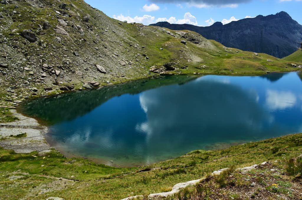
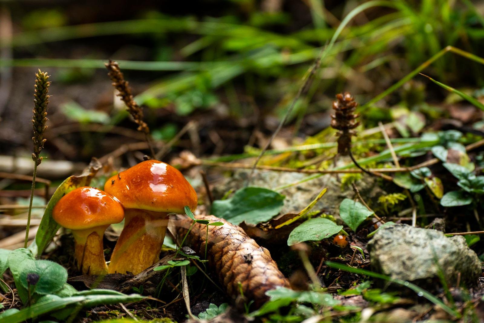
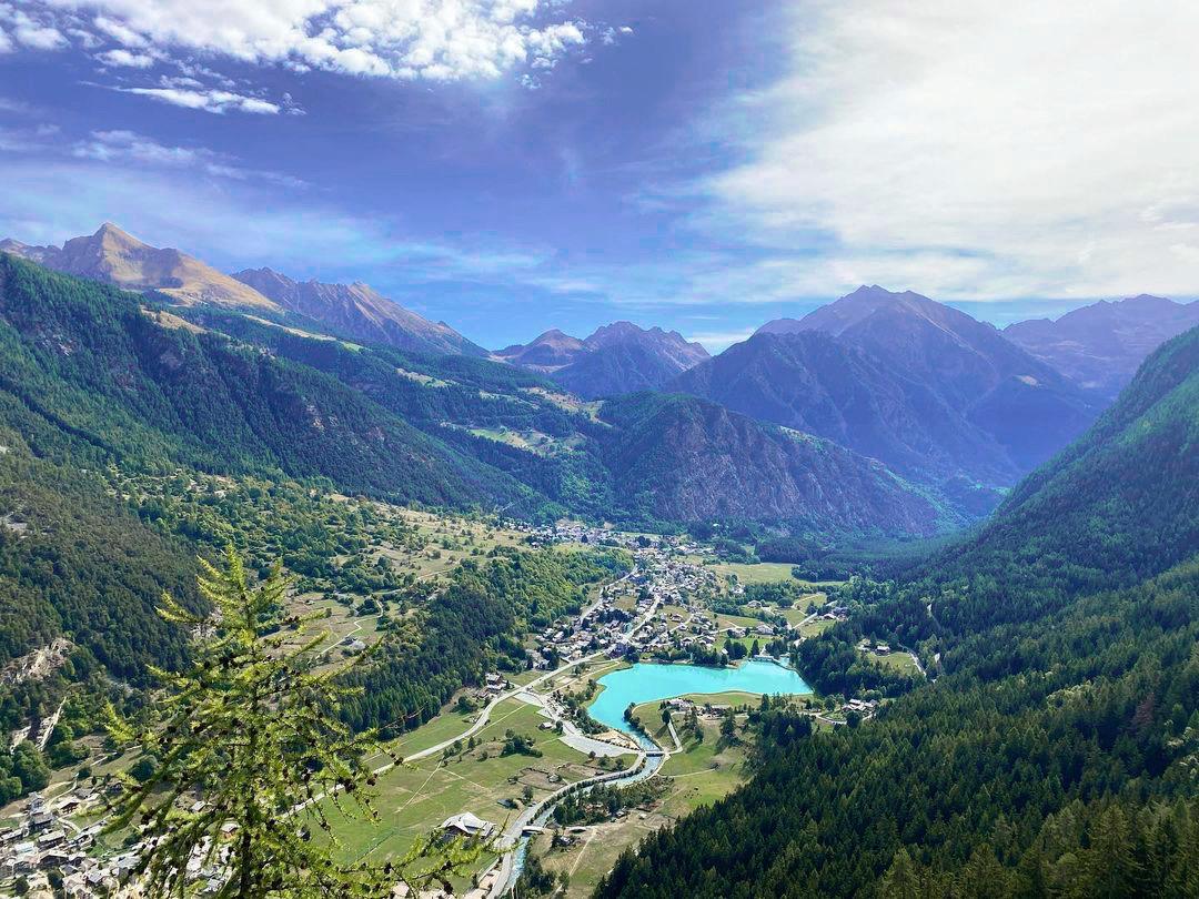
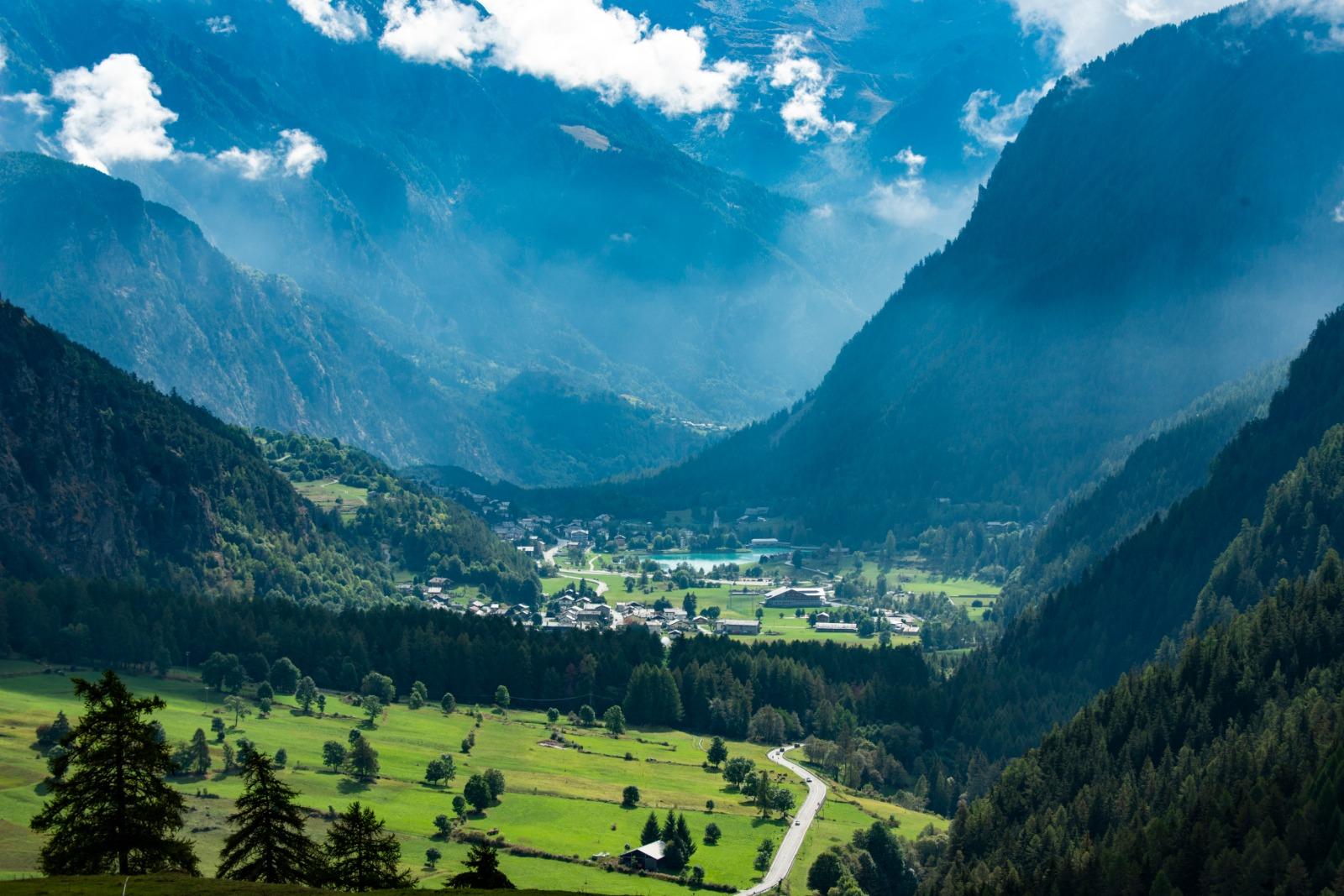
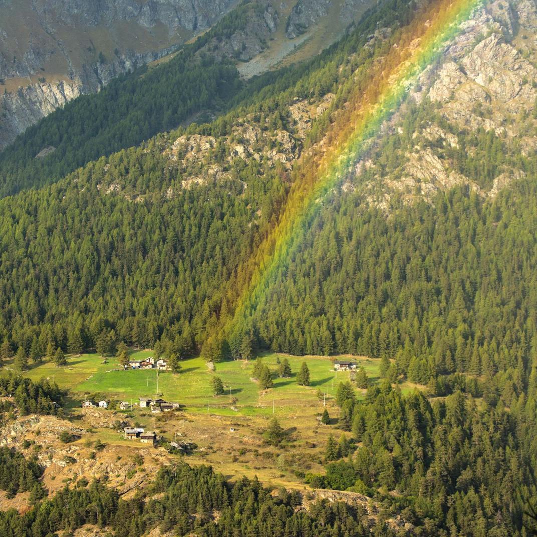
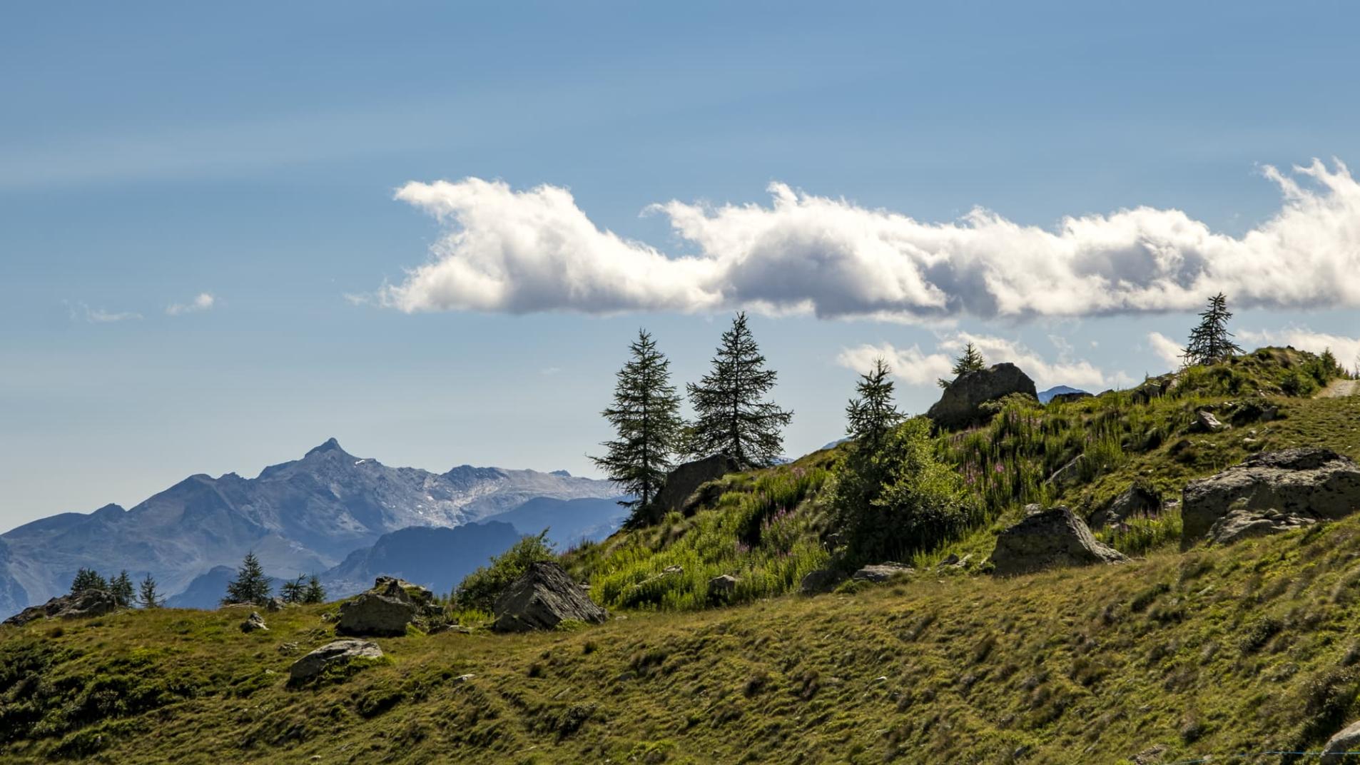
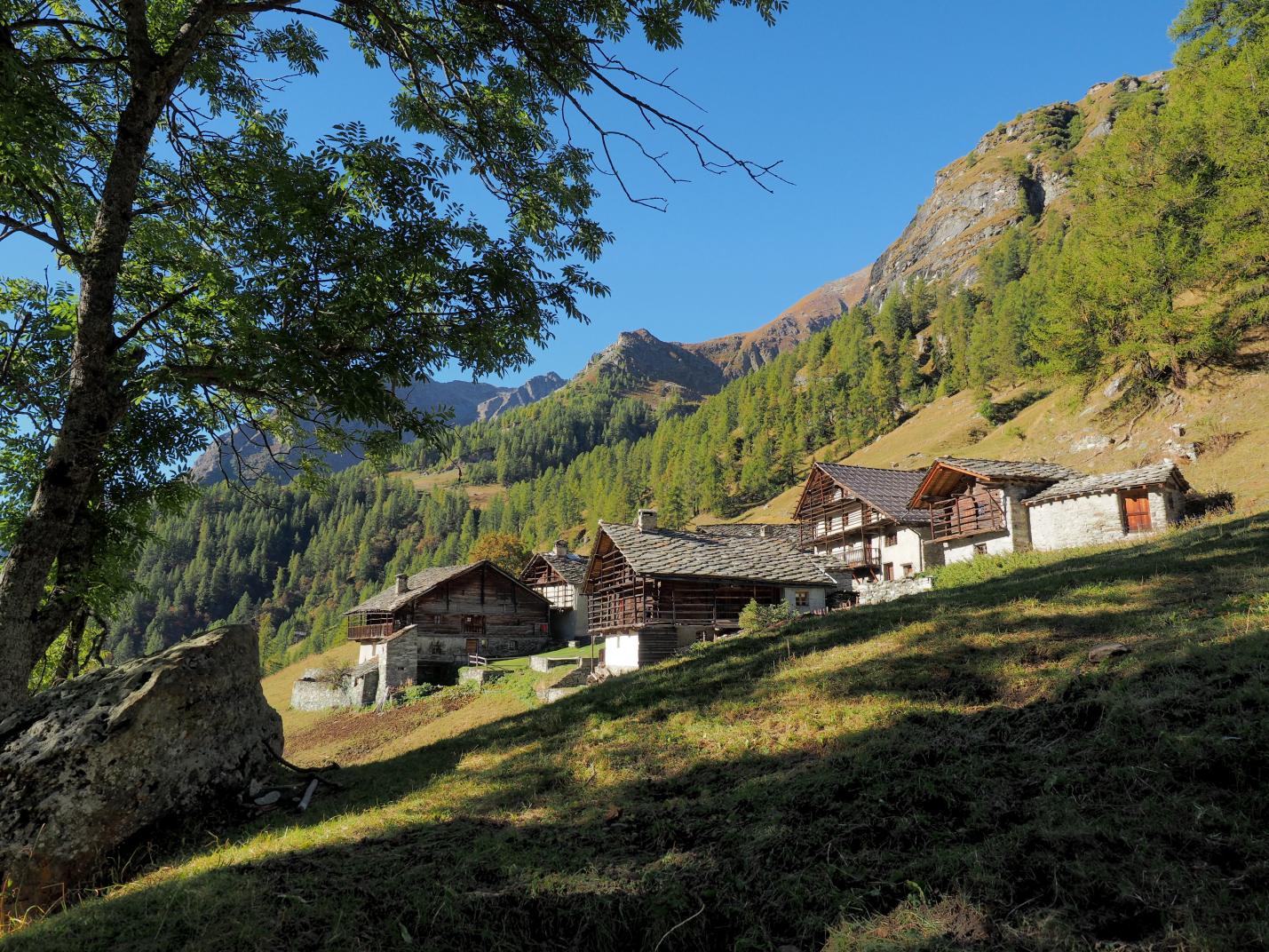
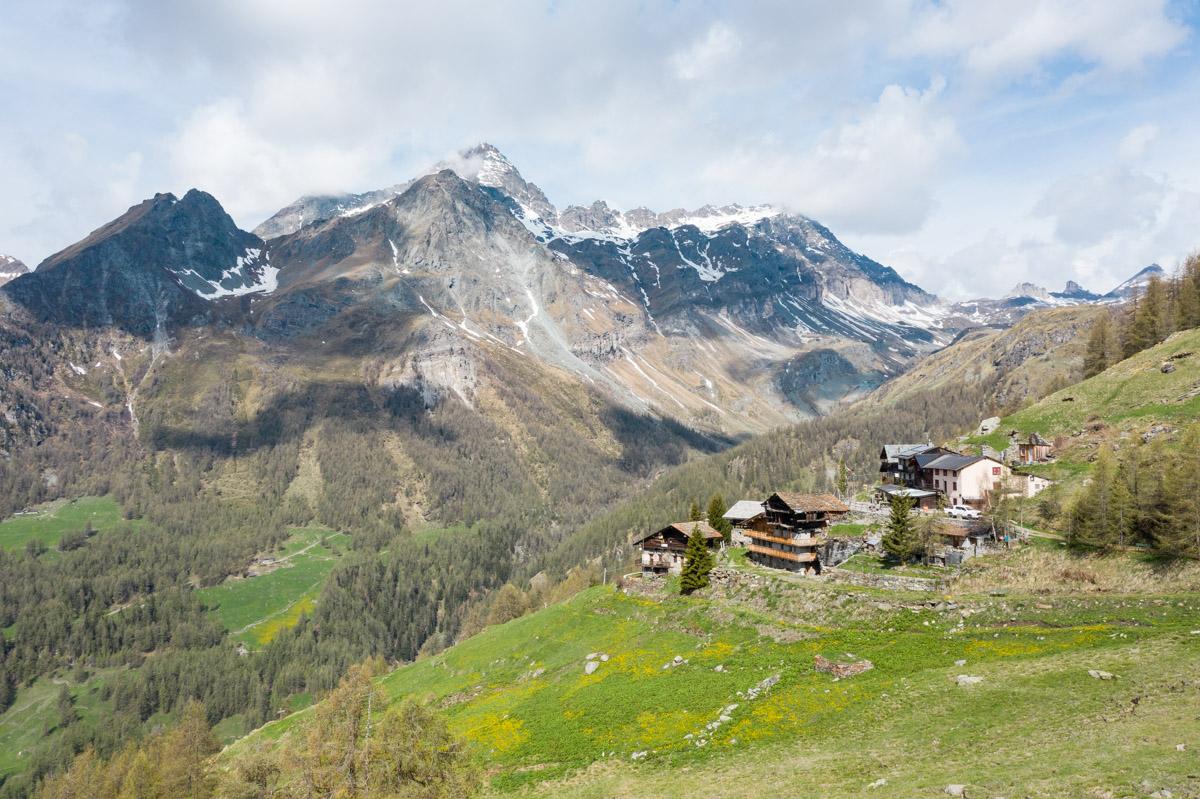
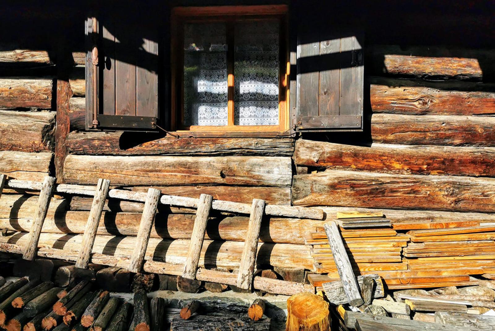
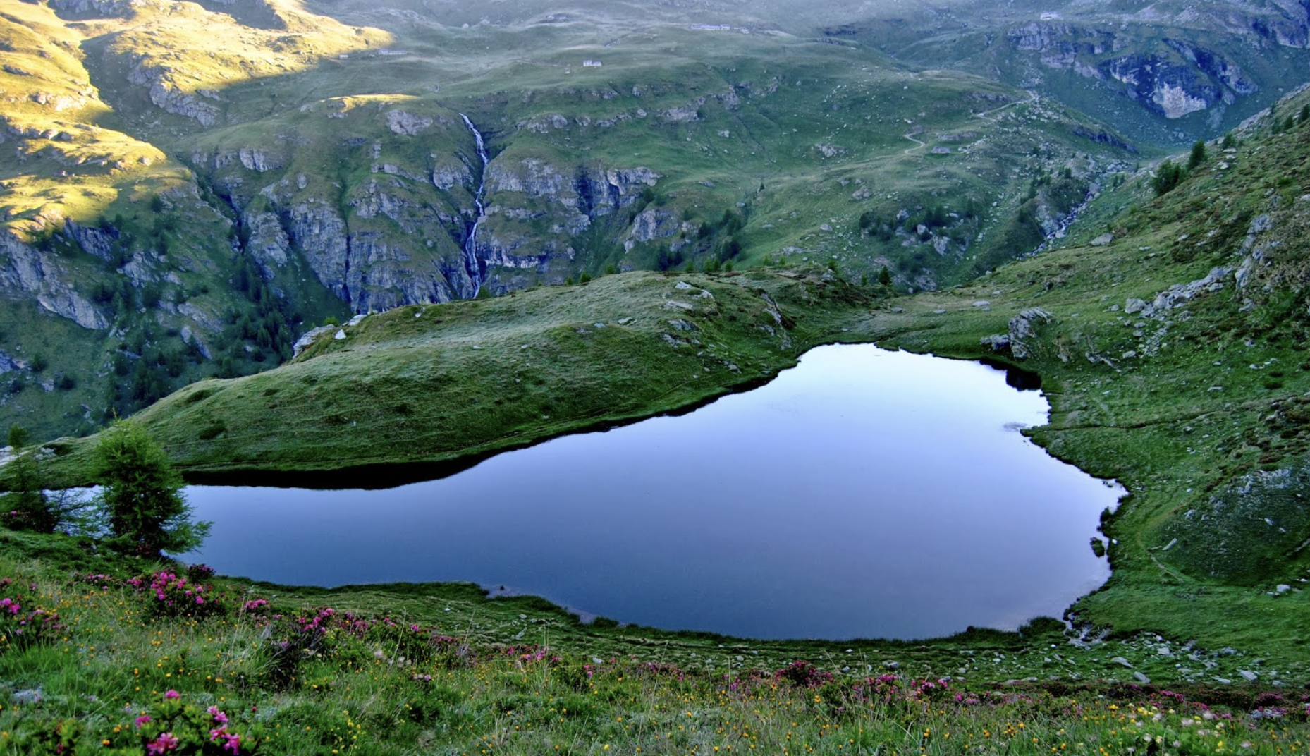
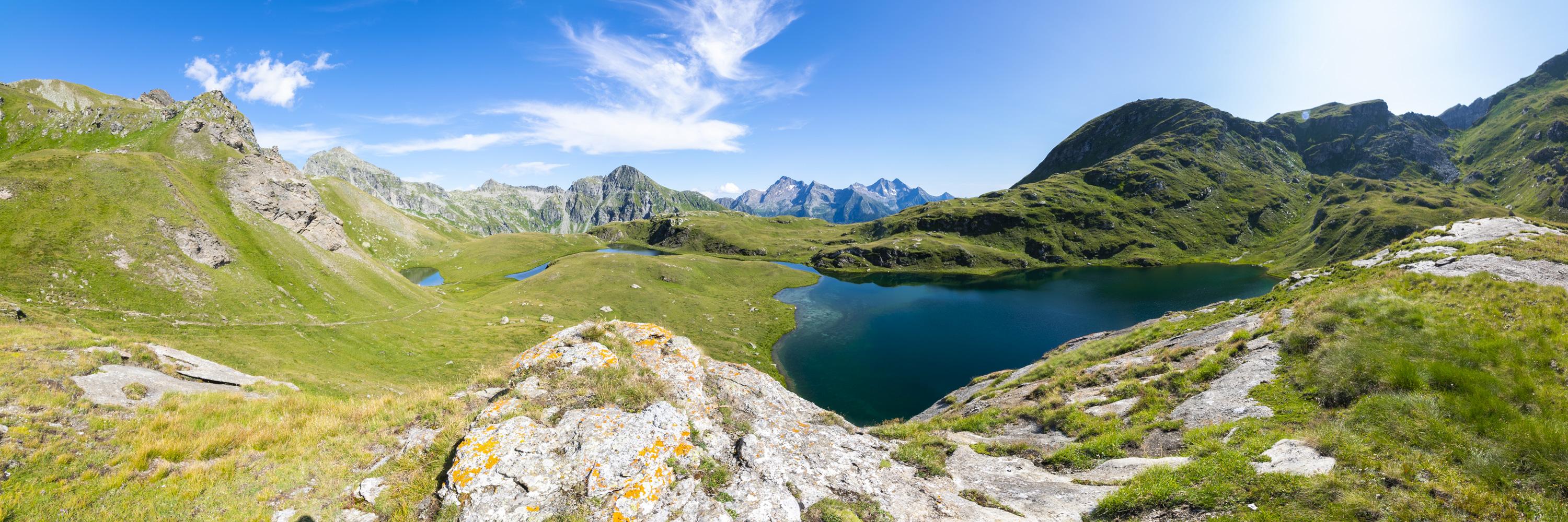
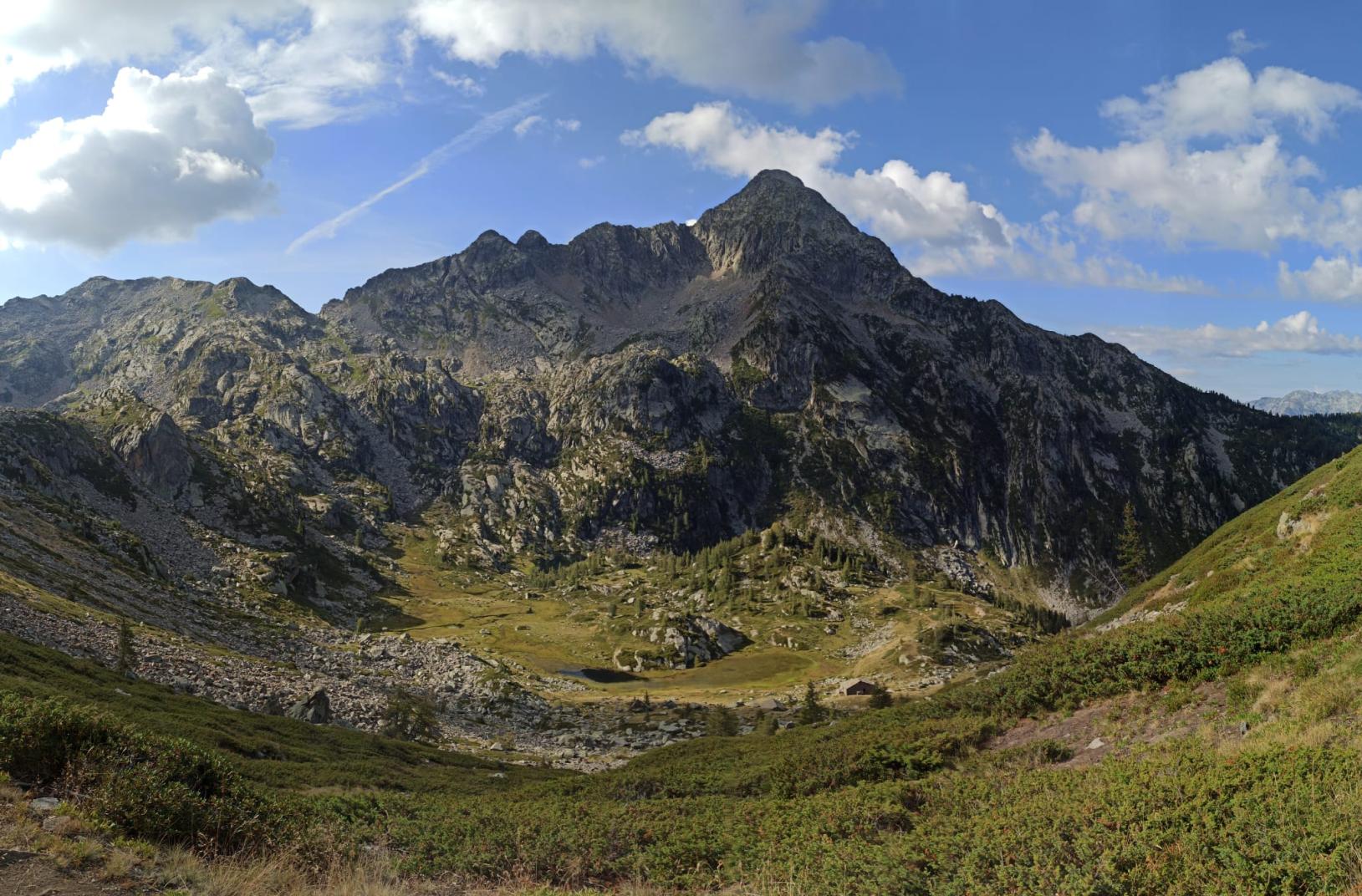
The absence of difficulty, limited elevation gain, and modularity (it can be completed in full or in part, with or without the use of ski lifts and with several ways to return to the valley) make it suitable for all walkers, especially beginners, while more experienced hikers will find it a pleasant and relaxing diversion. The route mostly follows dirt roads, with never steep slopes, and the parts on footpaths are simple, well-marked on the ground, and with few well-signposted branches. The final destination is the well-known Blue Lake, undoubtedly one of the most visited destinations in the entire valley; it is a magnificent body of water that owes its name to its characteristic color (see photo on the left) and is located in the lower part of the moraine of the Grande Ghiacciaio di Verra, at an altitude of 2211 meters. During the walk, you'll encounter two interesting places, Resy and Soussun, where you can see some ancient rascards, typical Walser constructions consisting of a lower part in masonry and an upper part in wood, supported by characteristic stone mushrooms. Crossing the Pian di Verra Inferiore then offers an exciting view of the glaciers on the western side of Monte Rosa, from the Gobba di Rollin to the Castore. Finally, on the shores of the Blue Lake, it is possible to find small beaches where you can rest before descending.


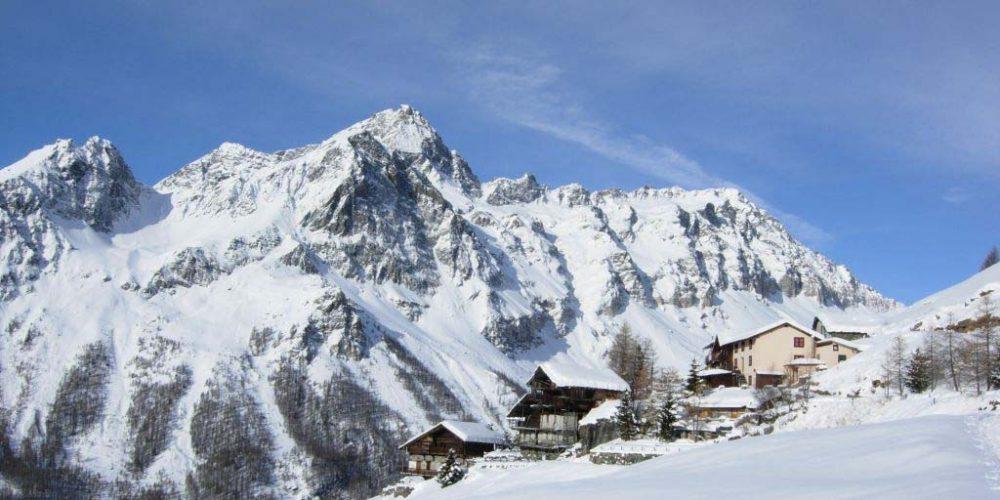
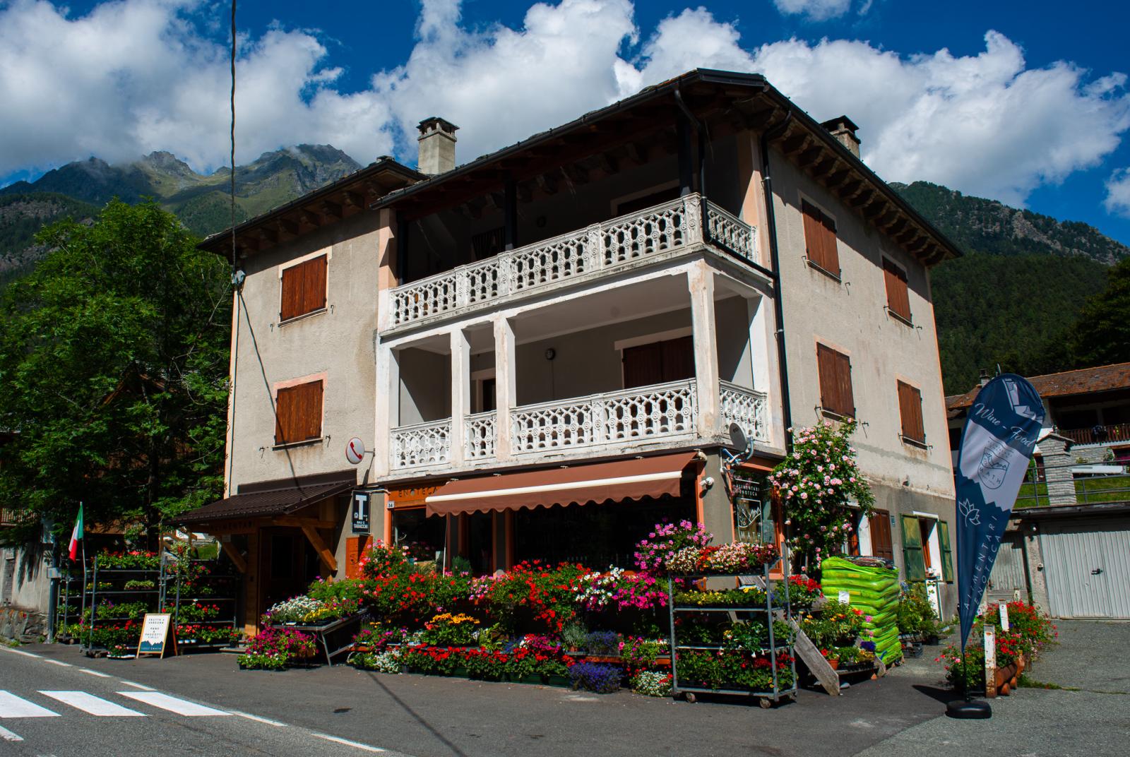
Section 1: Champoluc (1568 m) - Crest (2000 m).

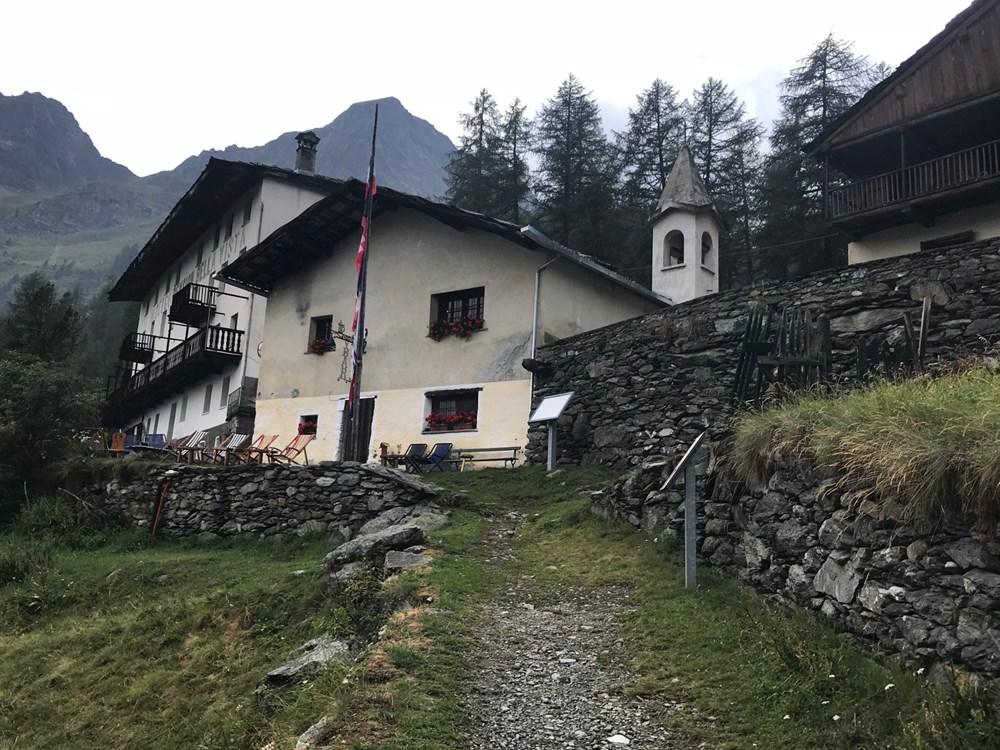
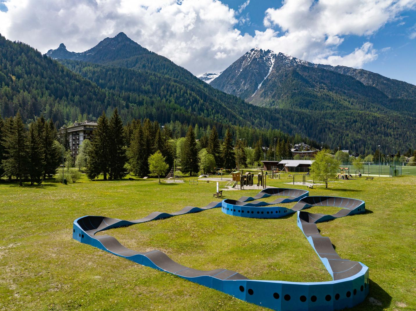
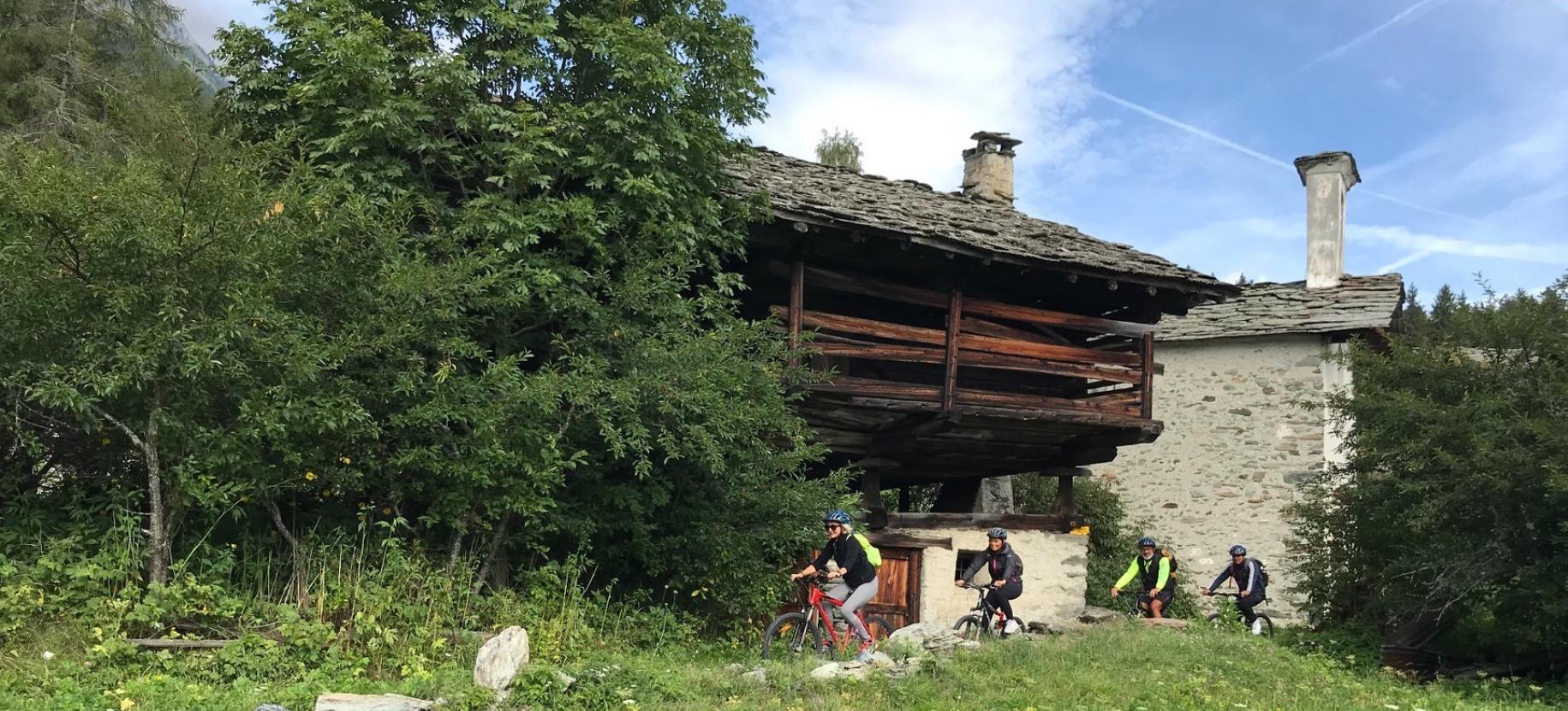
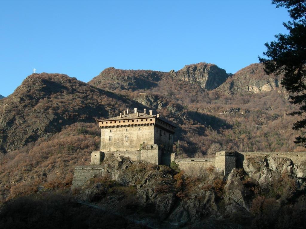
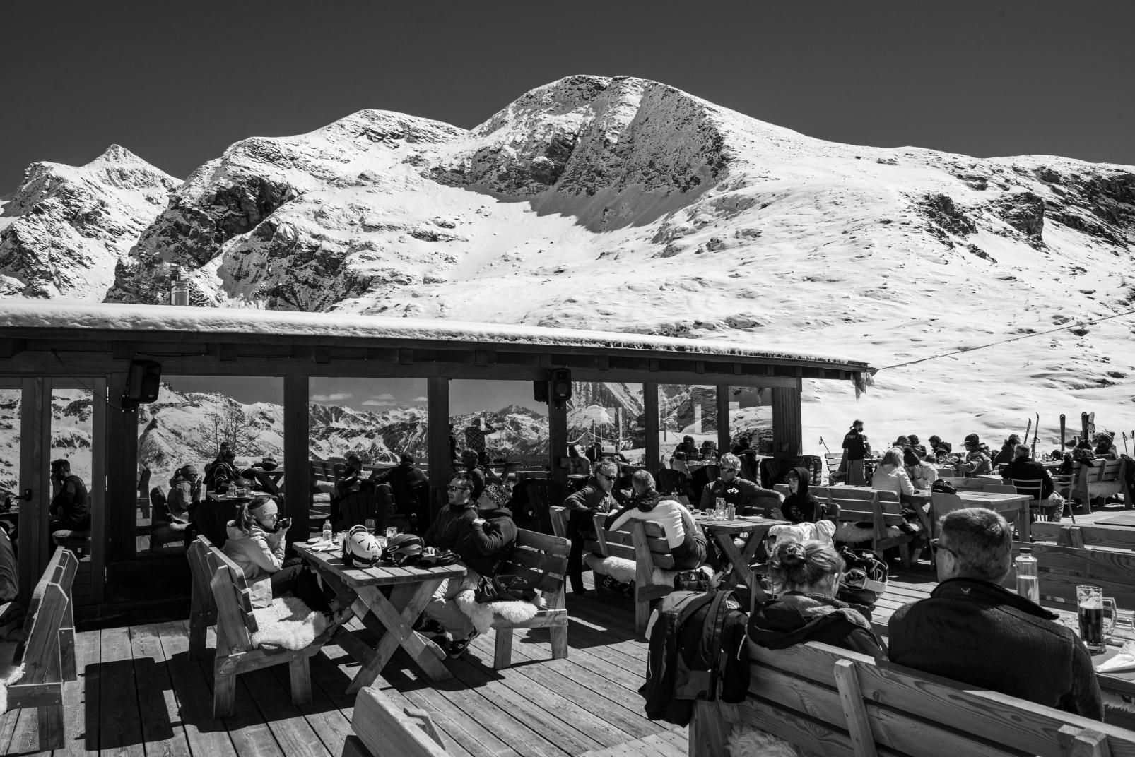
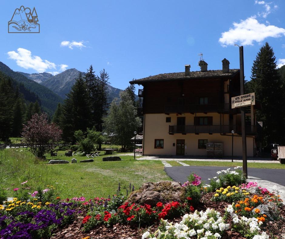
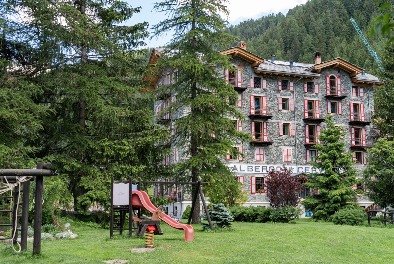
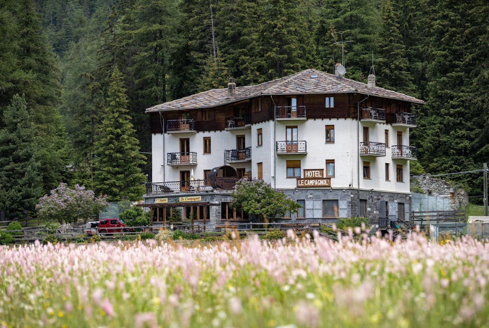
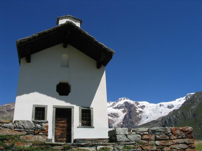
The ascent from Champoluc to Crest can be done by cable car - or more sportingly on foot - following trail 13 (also numbered 11A and 13B). The trail begins at Place Maître Dondeynaz, the central square of Champoluc: between the church and the cinema, there is an uphill road, and right on the corner of the church, there are a series of signposts: so follow this road, which immediately skirts a playground on the left; further up, the road ends and becomes a mule track, immediately indicated by signposts 11A, 13, and 13B. Follow it without encountering any forks. Starting from an altitude of about 1650 meters, the mule track begins to skirt the Crest - Champoluc ski slope, known as the "piston," leaving it on the left, then crossing it. After crossing, it ascends with some switchbacks and encounters a fork with a secondary trail that descends to the left, but stay on the main one. At a left-hand switchback, you encounter and pass a white and pink chapel dating back to 1845 but recently restored; in this part, the trail is occasionally lined with wooden fences, then continues to climb through the forest, emerging at around 1840 meters: from here, the village of Crest is in sight; behind the houses, you cannot fail to notice the cable car rising to the plateau above. You arrive at Frantze, a small cluster of mostly old houses; after passing the first house - inhabited until 2010 by Dina, the last inhabitant - turn left before the fountain, onto the path leading to Crest. Initially, this path is flat, then it ascends, cutting across the slope first to the left and then with two switchbacks until reaching the hamlet of Crest. Upon reaching the level of the first houses, turn immediately right to reach a small fountain just around the corner: here you will find a signpost with several directions. The proposed route passes through the cable car area, which can be useful as a point of reference (or starting point for those who have chosen the mechanical means to avoid this section), therefore, turn right onto trail number 11A, 11B, 13, and 13B; the trail to the left is the 13B to Resy - Soussun, and it can be followed to slightly shorten the walk (section not described), rejoining this route later, passing below the lift area. After the fountain, the ascent continues straight and steady: shortly after, you pass behind the Edelweiss hotel, then circumnavigate it counterclockwise, thus reaching the arrival point of the cable car from Champoluc. Here, there are some children's games and another fountain, useful for replenishing water supplies (the next one is in Soussun anyway).

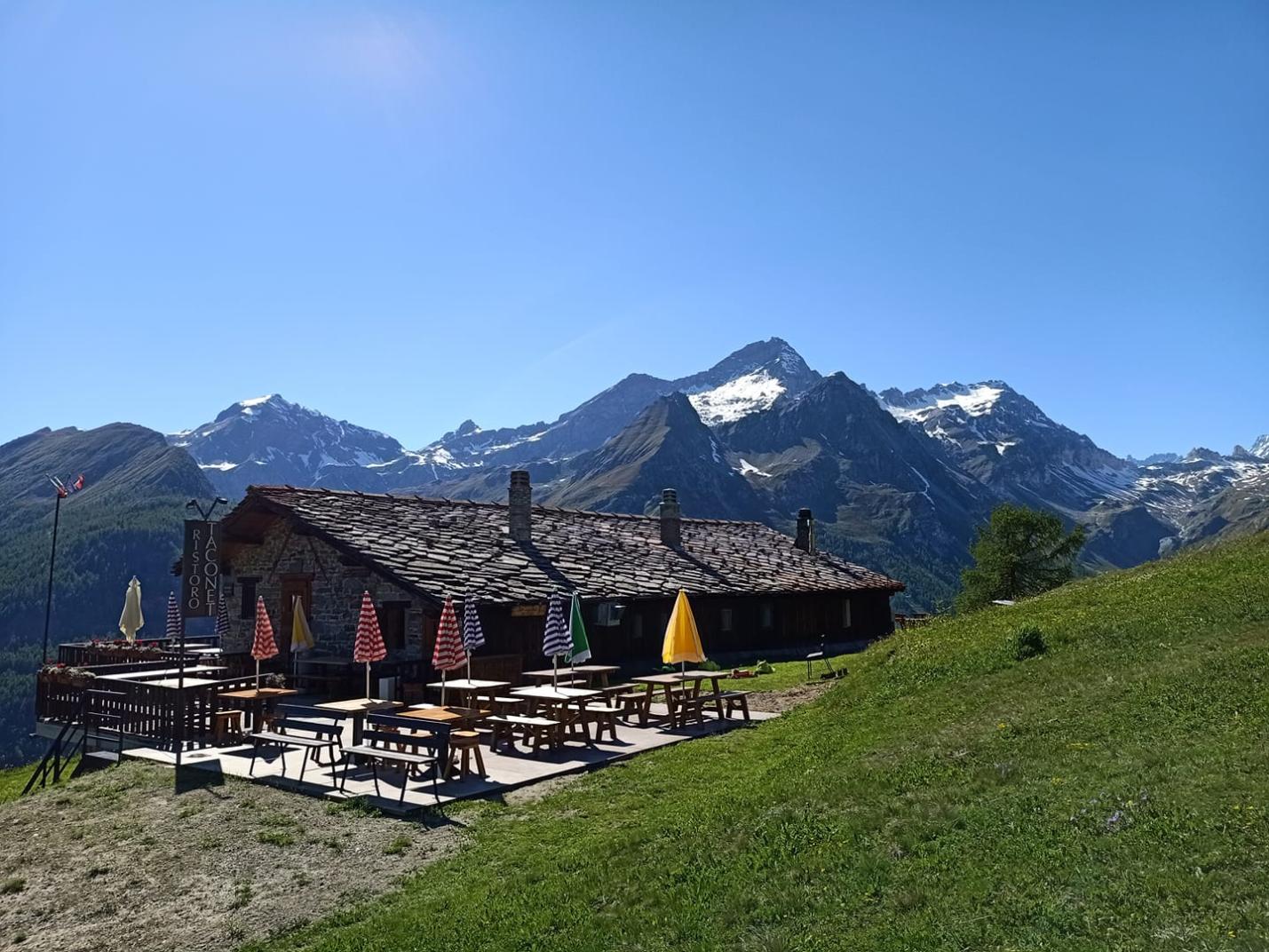
Section 2: Crest (2000 m) - Soussun - Resy (2066 m).

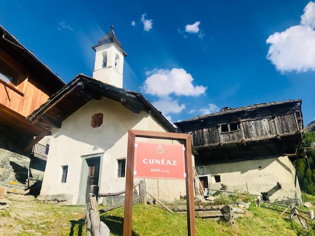
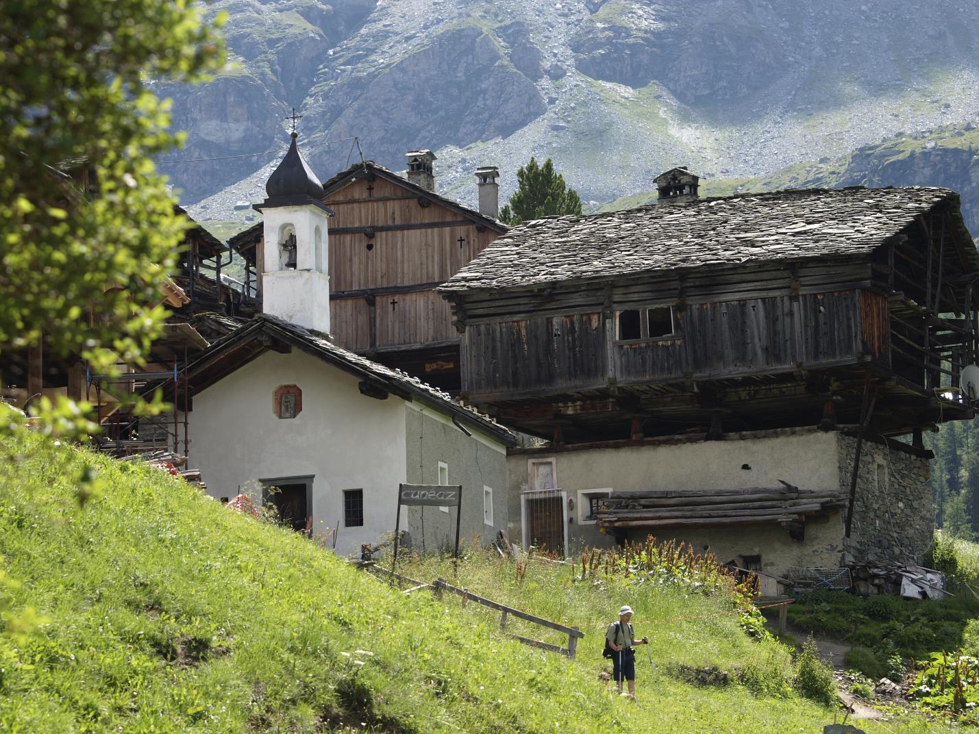
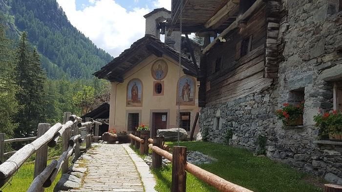
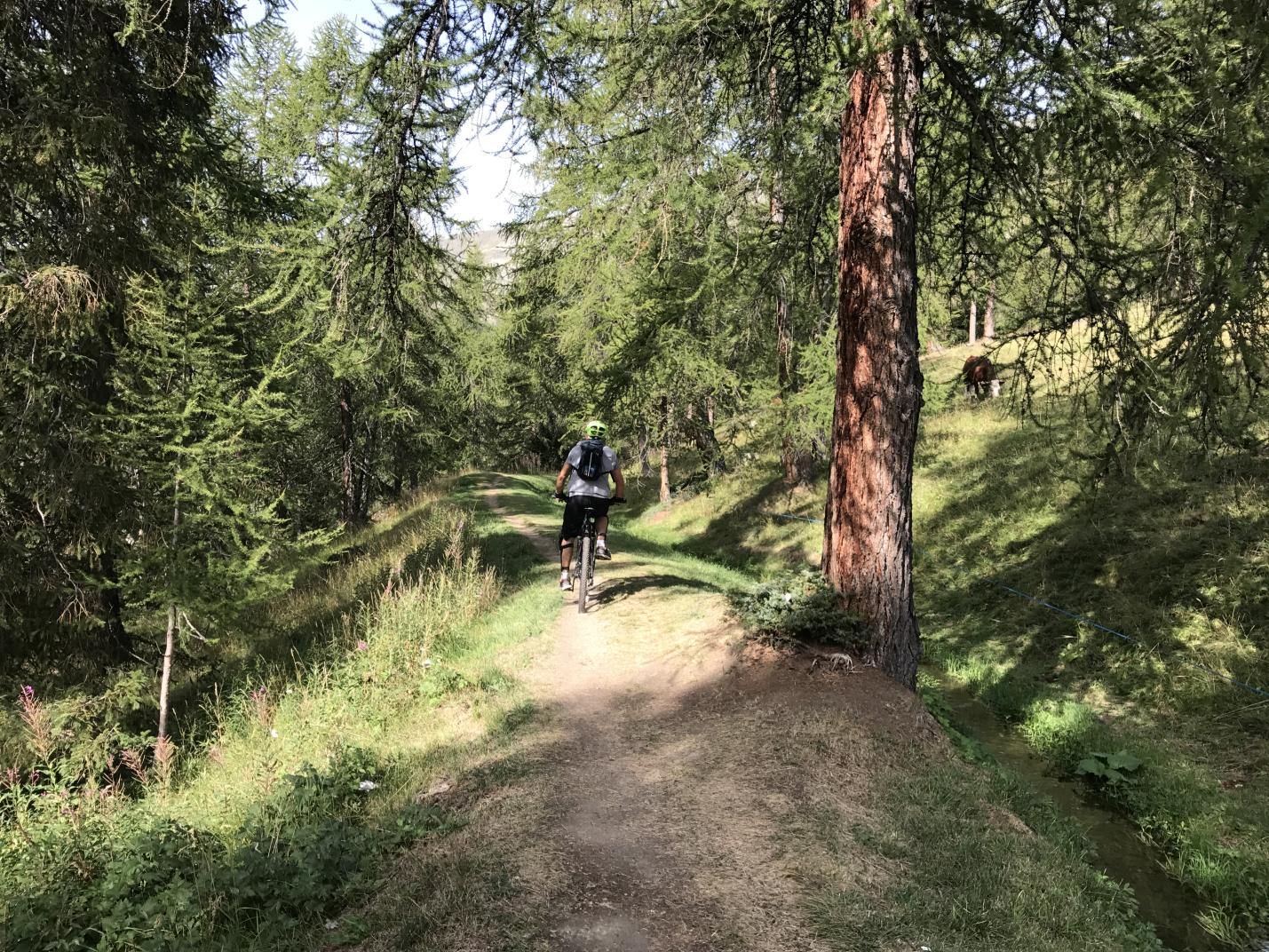
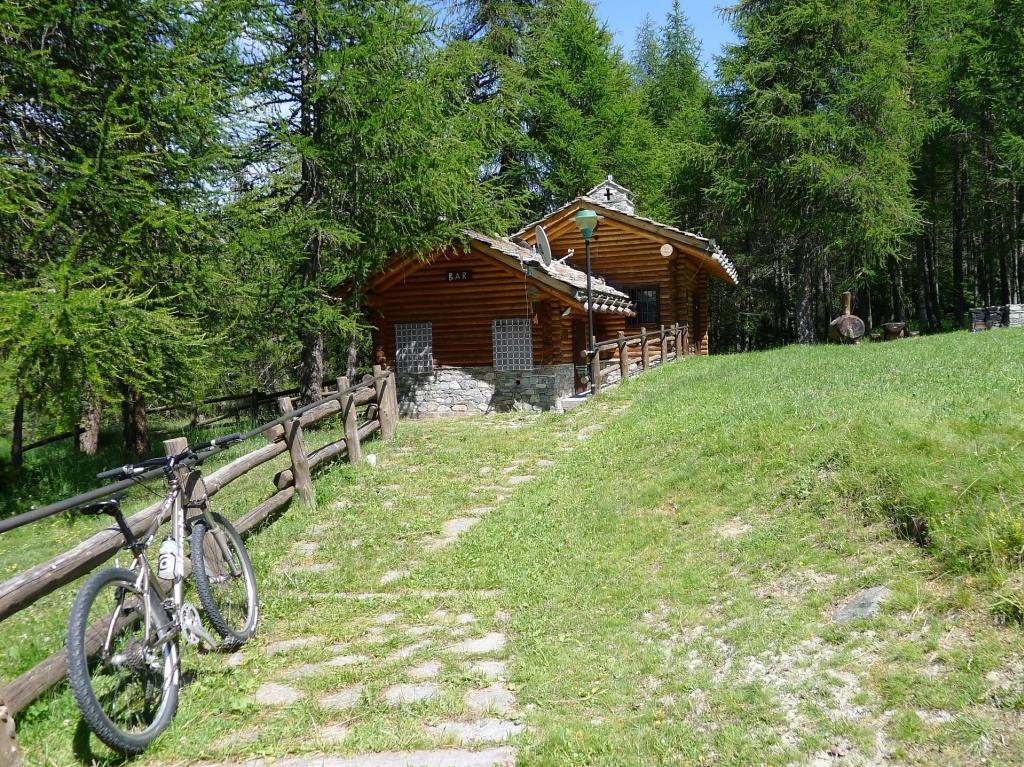
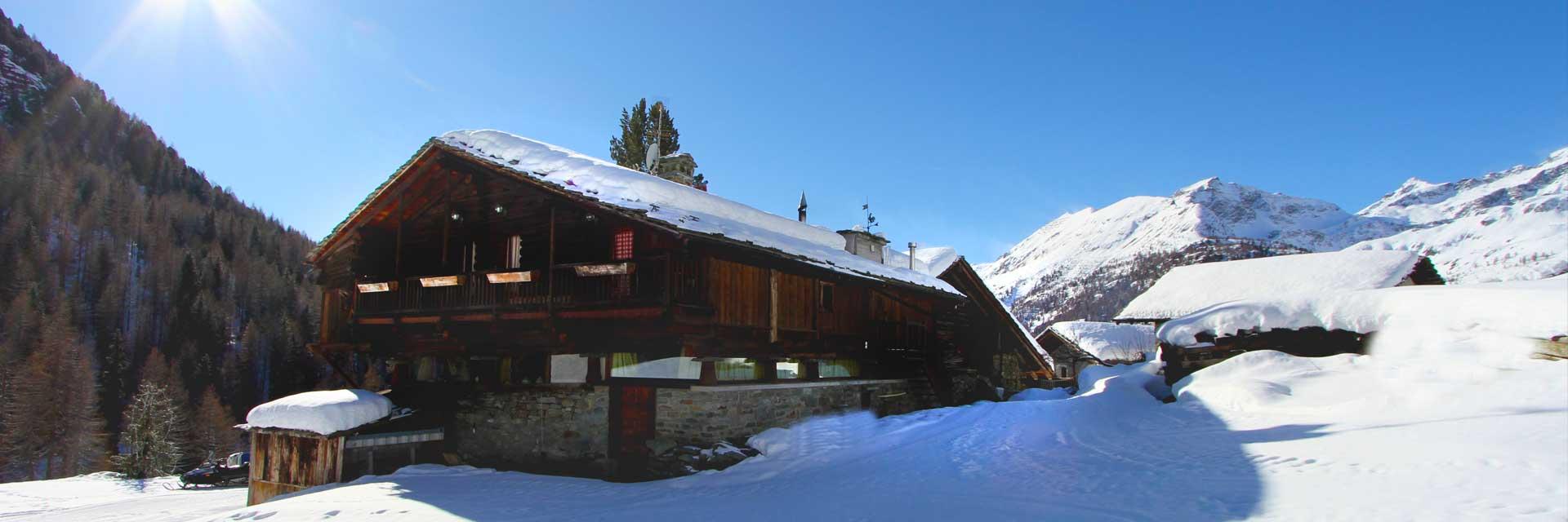
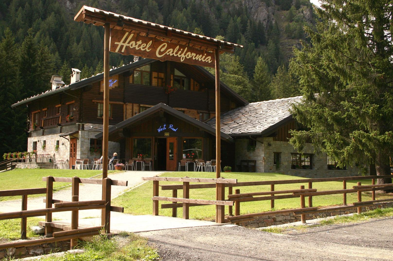
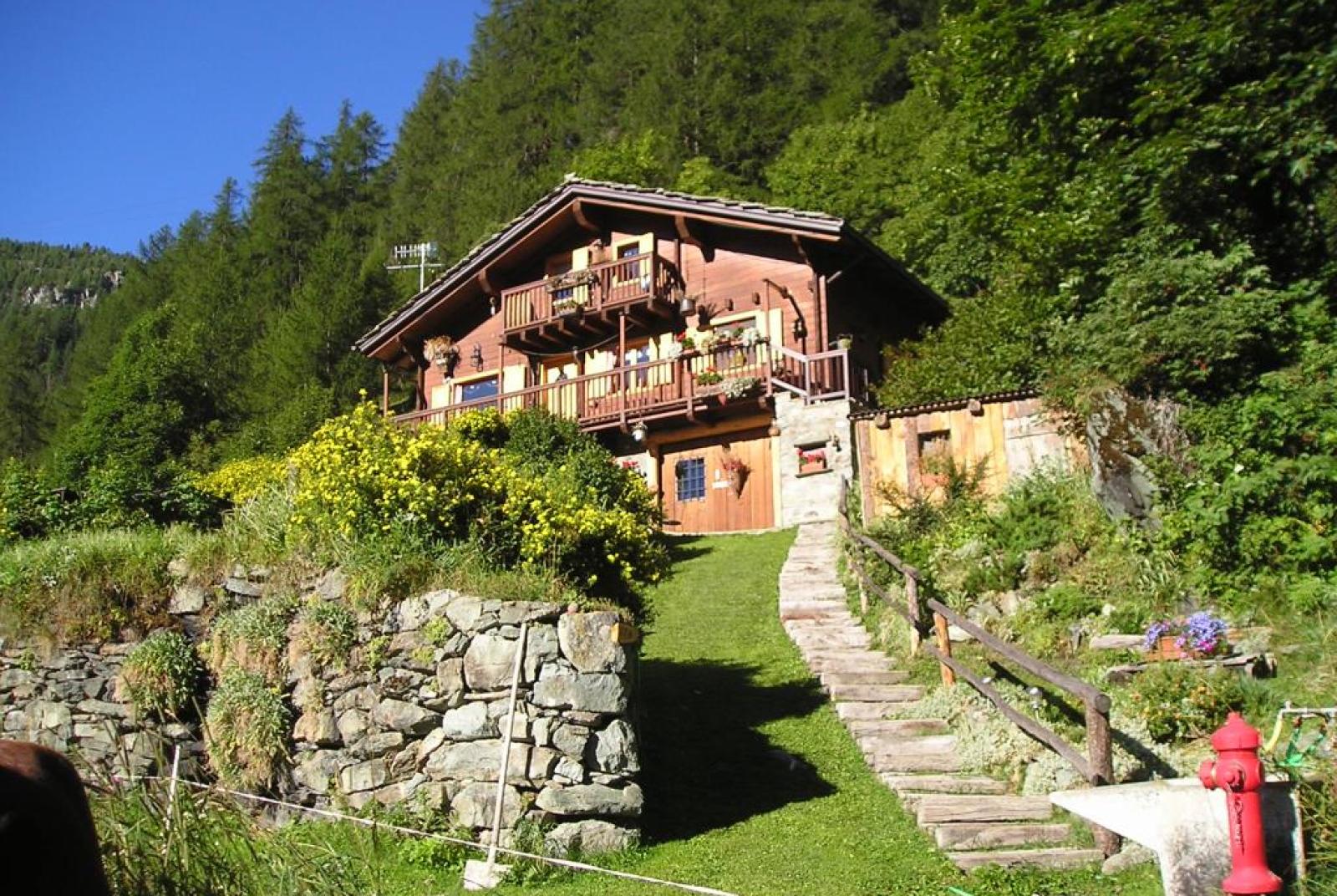
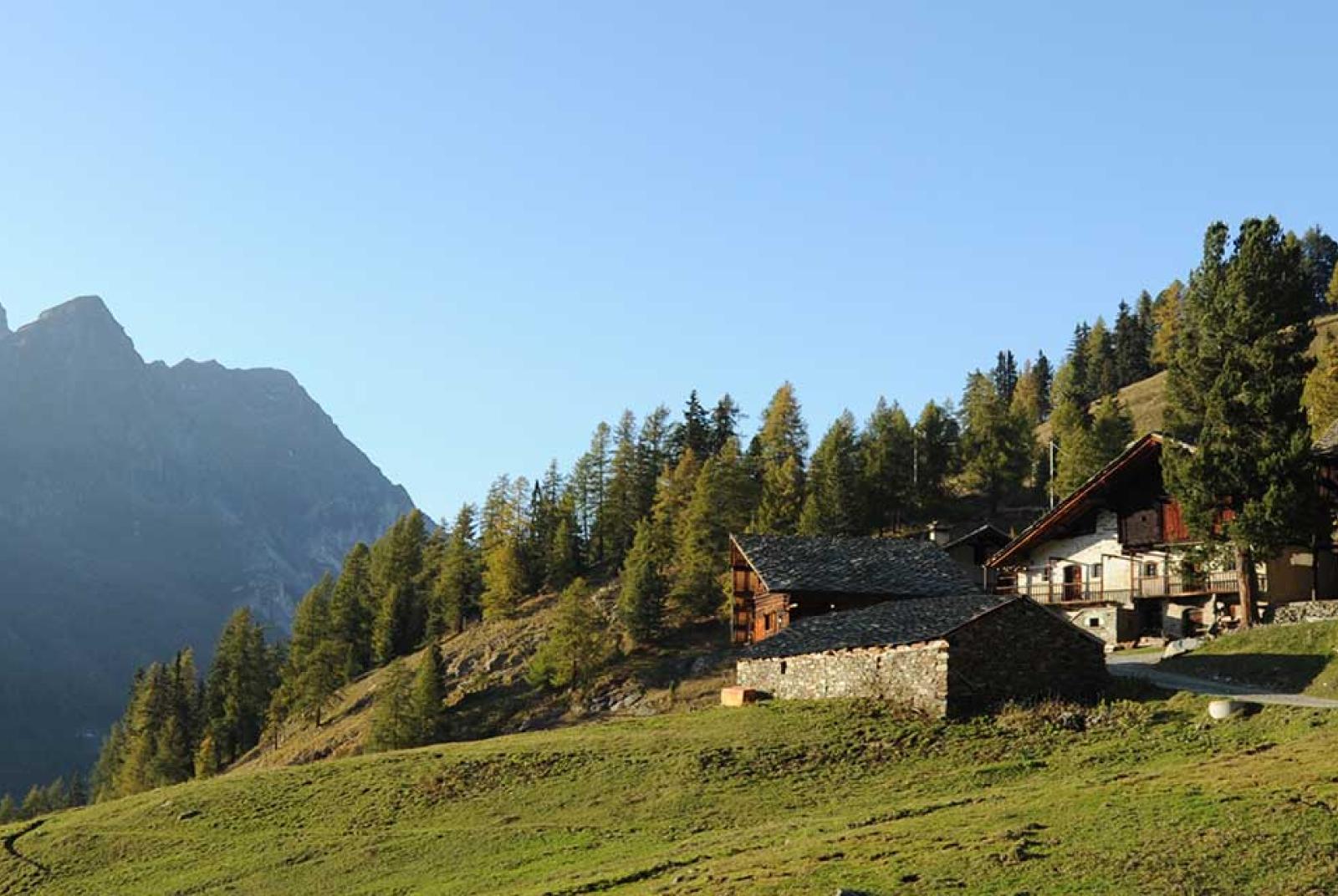
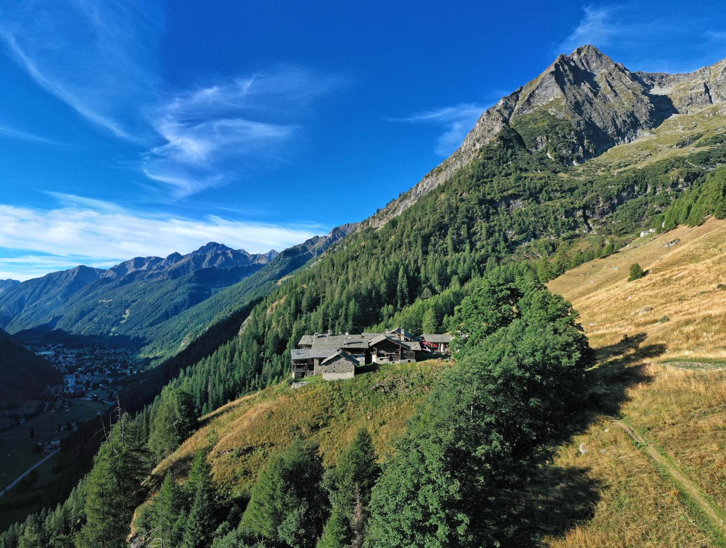
The elevation gain between Crest and Resy is minimal, but the route, a pleasant walk without any difficulty through the woods around 2000 meters, involves continuous ups and downs. Along the way, you pass through the characteristic Walser hamlet of Soussun. The trail resumes by skirting the large concrete building that houses the arrival of the cable car from Champoluc. At the back, you encounter two roads, one that ascends to the right and one to the left, taking the latter, also following the sign indicating the Belvedere refreshment point 45 minutes away. A few tens of meters later, you pass the path that descends to the left, staying on the uphill path to the right; leaving the cable car behind, you immediately face the Matterhorn. You pass by the Cre-Forné hotel, avoiding the road that leads to the hamlet just after it, staying to the left, and shortly after reaching a point where a trail separates to the right: it is the 10A/11 trail that ascends towards the lake area, but for Soussun, stay on the main road. A few tens of meters later, another road separates to the right: it is still the road to the lakes, and the previously discarded trail simply "cuts" the intersection; so, you remain on the lower road, proceeding straight. The road gains some altitude, then levels off, descends, and rises in a small hollow and meets trail number 1, GSW, and 13B: it is none other than the one coming from the Crest fountain in photo 9. There follows an alternation of small ups and downs; you encounter triangular signposts of the Alta Via No. 1 and yellow arrows. Before reaching Soussun, the road begins to descend to reach the Torrent de Soussun and cross it with a bridge. The main road does not pass through the village, describing a wide semicircle to the right, and you can stay on it (skirting the ruins of the old mill); to remain faithful to the route of both the Alta Via No. 1 and the Grande Sentiero Walser, turn left and head towards the settlement. Once you reach the first buildings, the road bends to the right to reach the restaurant, where it ends; instead of following it, continue straight ahead, facing a signpost with numerous directions near a fountain, as well as painted trail markers on the wall of the ancient rascard immediately behind the signs, dating back to the 15th century. Naturally, follow to the right, as indicated by the usual signposts 1, GSW, and 13B, avoiding the 10 to the left, which descends to Frachey, ascending between the houses. Pass to the right of the group formed by the Chapel of the Madonna del Carmine and the ruined house to its right, passing the latter and thus exiting the settlement. Here the trail ascends towards the road first on slightly inclined plates, which could be slippery if wet, then on terrain.

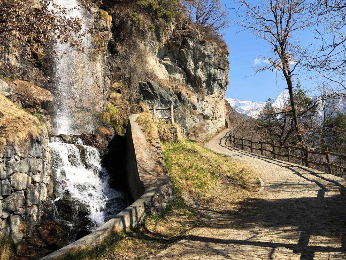
The last stretch; with some steps, it slightly bends to the right to join the road; here are two stone slabs with trail markers GSW, 13B, 10, and 1. So, turn left and continue the uphill path, with a view of Champoluc. A few minutes later, you encounter another fork; to the right, the road - also numbered as trail 10 - leads to Alpe Taconet, the ski area, and the Vallone della Forca; once again, stay on the lower road, proceeding straight and passing a section bordered on the left by movable nets to protect skiers (in winter, this road becomes a ski slope). Immediately after the netted section, the road descends sharply towards the area below, which houses the departure of a chairlift and, slightly higher, the arrival of the funicular from Frachey, inaugurated at the beginning of the 2009/2010 ski season. You pass in front of the chairlift departure - which doesn't operate in summer - and the bar/restaurant "Lo Retsígnon," then encounter a fork; continue straight, ignoring the road that ascends to the right towards the upper refreshment point and the upper station of the funicular (this road actually descends later and rejoins the main one, but it's unnecessary to include an extra ascent and descent). The road starts to descend, passing under the funicular tracks, and continues to descend as Resy comes into view. About 200 meters later, at a left-hand switchback, the road forks; following the road descends to St.-Jacques/Croisette, but for Resy, turn right, following the signs indicating Resy is a 35-minute walk away. The road starts to ascend again, then the slope reduces, encountering a new fork: here, continue straight again, ignoring the road descending from the right (it's the upper branch coming from the upper station of the funicular). The path begins to undulate; in winter, this is also a ski slope. The road then encounters one last fork: here, leave the track of the slope, following the signs for Resy and trail marker 1 to the left. Shortly after, the road ends, but the trail crosses a bridge, then ascends on the opposite slope with two wide, partially paved switchbacks with steps. After the second switchback, a short stretch is protected on the left by a wooden railing about 8 meters long. The trail ascends again, then bends to the right and encounters a fork: here, the new TMR track branches off to the right towards Lake Contenery, but to reach Resy, keep left on the trail, which maintains the numbering 1, GSW, and 13B. The path turns left, crosses a rusty stream with a bridge, then continues to ascend, pleasantly cutting across the slope to the right with some small ups and downs. Along a wide right-hand curve, the trail comes into view of Resy; the bottom is now paved to better traverse this otherwise muddy area. With one last wooden bridge, the trail joins the road from Resy to Bettaforca near a signpost rich in indications; turning left, you reach the village (of the roads that cross it, the one on the flat will then continue towards Pian di Verra).

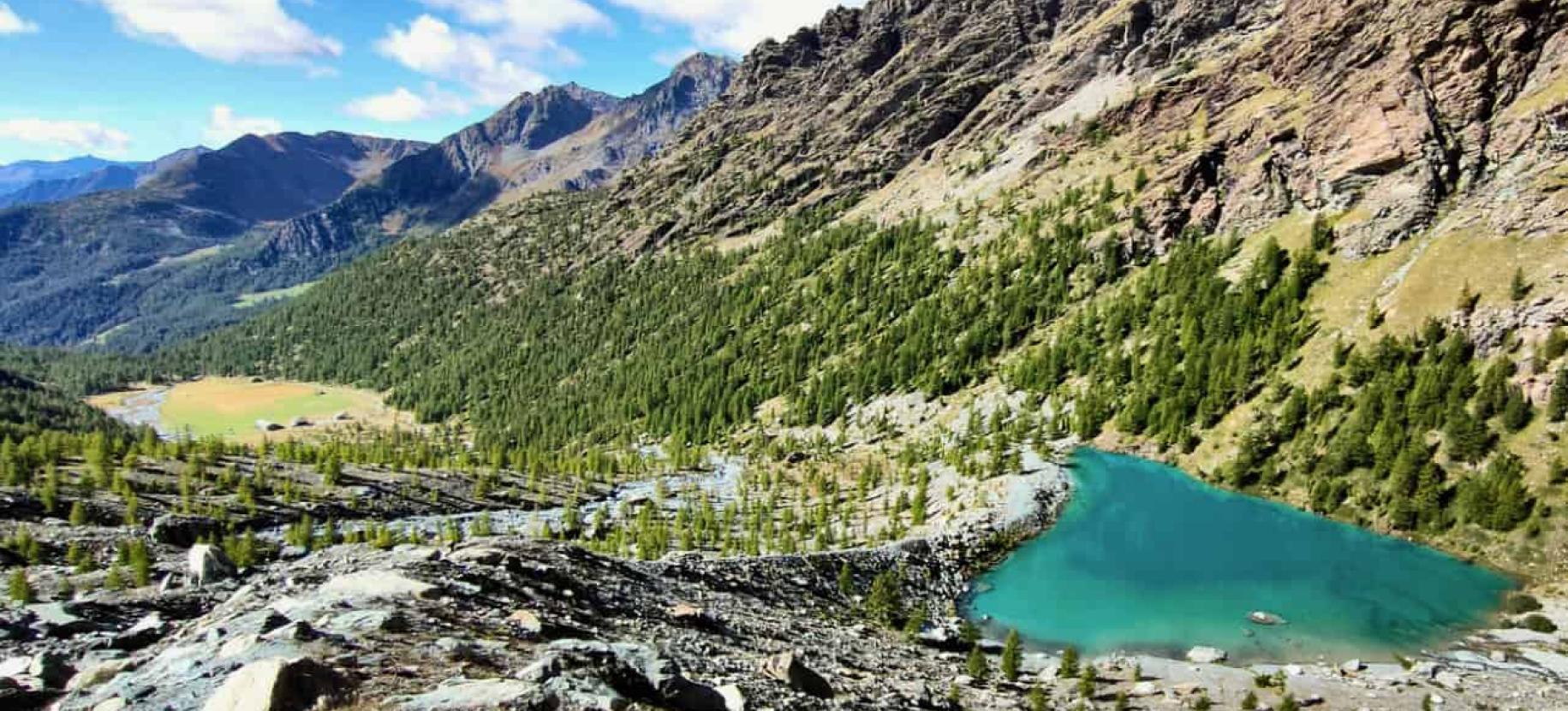
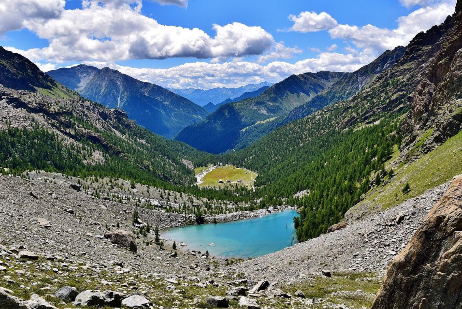
Section 3: Resy (2066 m) - Pian di Verra Inferiore (2040 m).

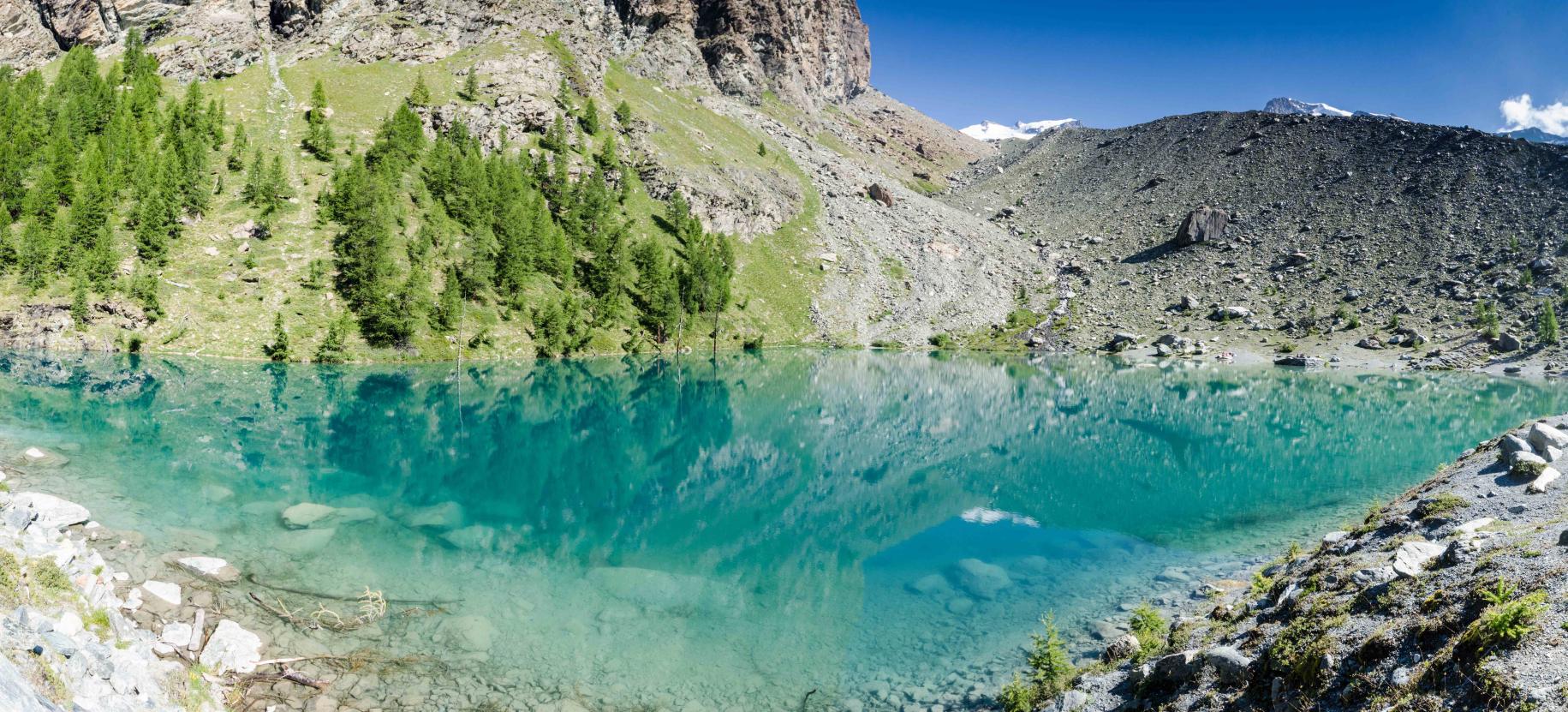
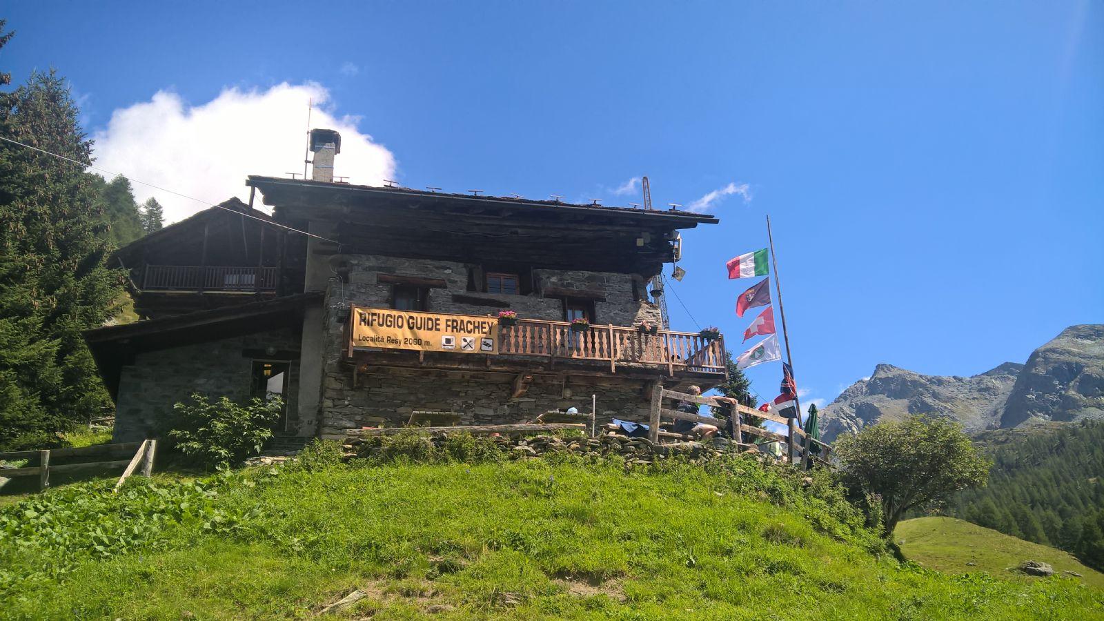
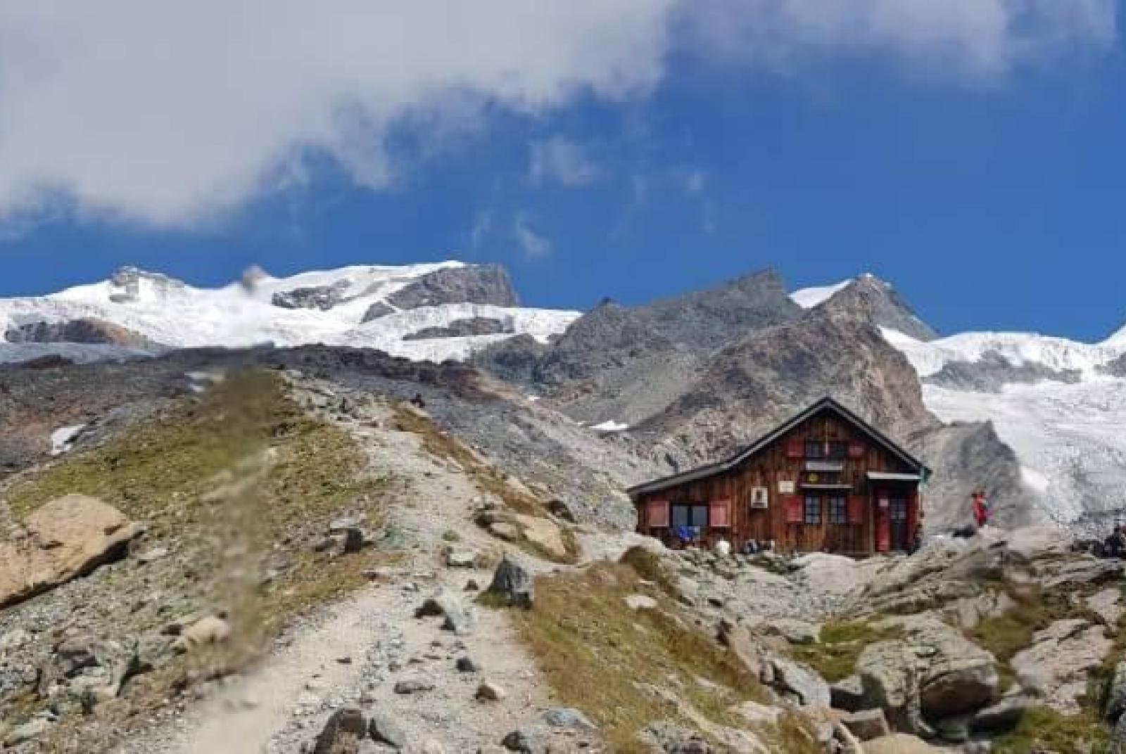
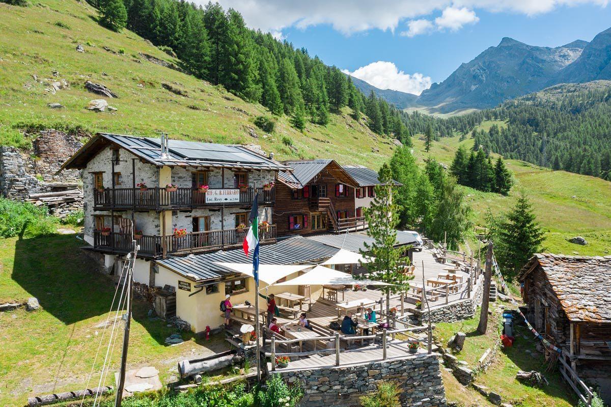
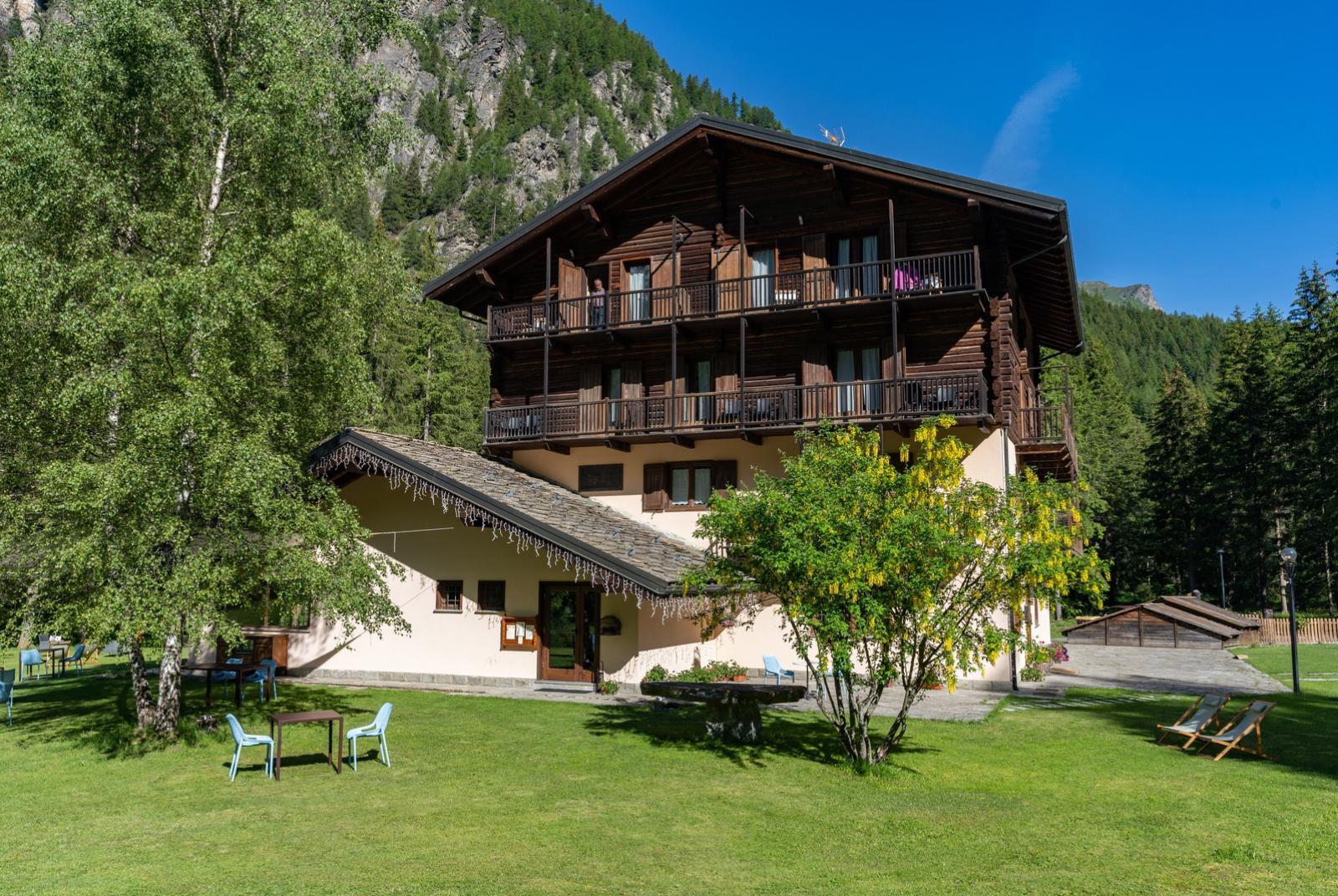
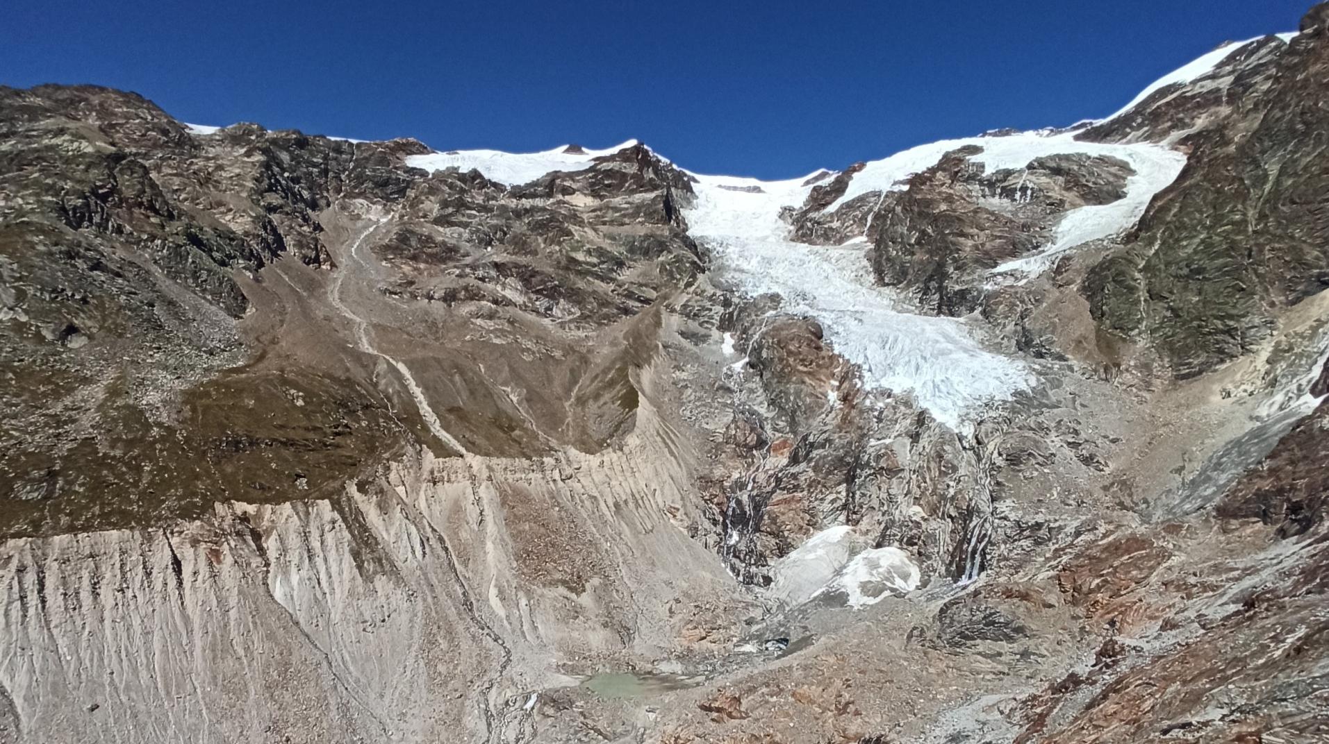
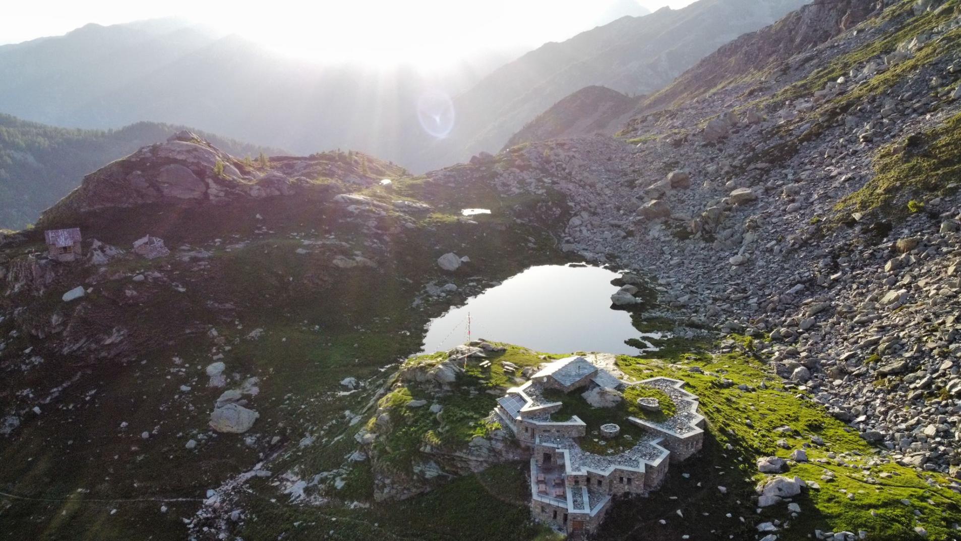
At Resy, you pass in front of Rifugio Ferraro, often crowded with tables; you encounter the beginning of trail 9, which descends towards St.-Jacques, but you continue straight (unless you want to shorten the route), thus taking trail 8B/TMR. The signs indicate Pian di Verra Inferiore is a 45-minute walk away. The trail cuts the slightly uphill slope entering the woods, and then proceeds with a more level path, indicated by yellow arrows. Then, you face a descent; here, the ground is composed of small rocks and stones firmly embedded in the terrain, but made slippery (especially when wet) by the considerable foot traffic. Some ups and downs follow; after a sudden right turn, the noise of the stream below becomes audible, and glimpses of the Rosa glaciers appear through the tree branches. The trail then descends with some steps and meets the road coming up from St.-Jacques. Here, you turn left, following the TMR indications. The road now runs alongside a stretch of stream flowing through a beautiful grassy basin dotted with boulders, a true miniature valley. Approaching Pian di Verra Inferiore, the road curves in an S shape, near which, to the right, there is a building part of the municipal aqueduct; subsequently, about ten meters further, the remains of the ancient village of Verra are visible on the right, one of the oldest Walser hamlets in Ayas, whose rascards were dismantled and reassembled in St.-Jacques with the arrival of the Little Ice Age. You have now arrived at Pian di Verra Inferiore, and if the weather is favorable, the spectacle of the glaciers and the 4000-meter peaks from the Central Breithorn to the Castor unfolds before you; the Mezzalama and Guide di Ayas refuges are already visible, and above all, the basin hosting the Blue Lake, the final destination of this itinerary. The road finally curves left, crosses the bridge over the Evançon, and in the next, nearby right-hand curve, near a large and characteristic pyramid-shaped erratic boulder and especially a signpost with several directions, it joins trail GSW/TMR/7 coming from St.-Jacques via Fiery/Beaubois at an altitude of about 2040 meters. The road, now numbered 7 and 8, continues straight towards the northern end of Pian di Verra Inferiore, where the final stretch of trail before the Blue Lake begins.

Section 4: Pian di Verra Inferiore (2040 m) - Lago Blu (2211 m).

Pian di Verra Inferiore isn't deserted or uninhabited; it hosts several buildings (pastures and dwellings), near which, indicated by a signpost, trail 8 branches off from the road towards Colle Bettolina, but for Blue Lake, you remain on the main road. Arriving at the northern end of Pian di Verra Inferiore, the road bends to the right and crosses the Verra Stream with a bridge; before the bridge and at the bend, the beginning of the final stretch of trail to the lake is very evident, numbered 7 and still highlighted by vertical signage.

Note: shortly after the bridge, there is a drinking water fountain.

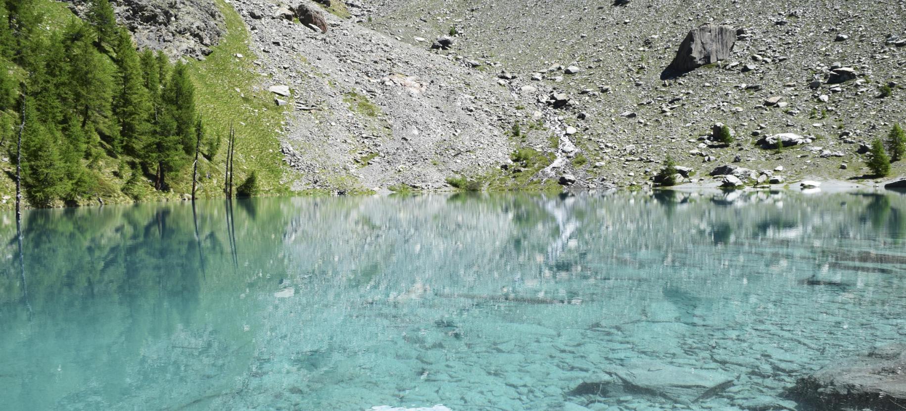
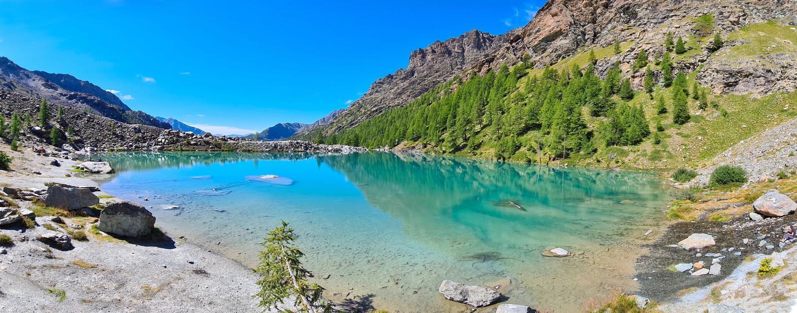
Staying on trail 7, you begin to ascend along the stream; the ground is composed of earth and rocks but poses no particular problems for progress. The arrival at the moraine basin hosting the lake is signaled by the appearance of a stone bridge, recently built, which crosses the lake's outflow: a few meters from the bridge is the southern shore of Blue Lake. The lake can be comfortably circumvented, preferably counterclockwise; on the northern shore, there is a convenient small beach.

Section 5: Blue Lake (2211 m) - St.-Jacques (1686 m).

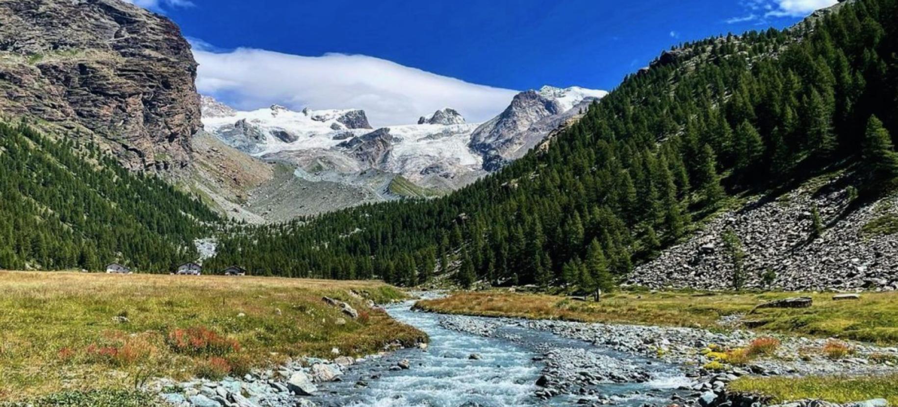
The descent from Blue Lake to Pian di Verra Inferiore follows the most commonly used ascent route to Blue Lake, namely the direct route to St.-Jacques via Pian di Verra Inferiore - Beaubois - Fiery - Blanchard. From the southwest shore of the lake, after crossing the bridge, take trail 7, which after about 400 meters rejoins the dirt road of Pian di Verra Inferiore where it begins to climb towards Pian di Verra Superiore. Once on the plateau, cross it southwards until the road gently curves to the left, near a large pyramid-shaped erratic boulder; here, leave the road (unless you want to use it all the way down instead of the trail) and turn onto the trail - indicated by a signpost - passing to the right of the mentioned erratic boulder. Shortly after leaving Pian di Verra Inferiore, ignore the unnumbered right deviation and continue on the trail, initially descending gently; further ahead, you encounter the junction where trail 8E/TMR for Valletta di Tzère begins, but stay on the left branch, thus reaching Beaubois; without leaving the well-marked wide trail, descend to Fiery, turning left at the junction just before the village (clear signs are present). The trail, now steeper, quickly regains the Blanchard area, becoming paved; after crossing the small wooden bridge, turn left and descend on a stepped mule track until you reach the houses. After crossing the stream again (now the Evançon), you finally encounter the asphalt road and follow it downhill until the end of the itinerary, the square of St.-Jacques.

lago blu

lago blu

lago blu

lago blu

lago blu

lago blu

lago blu

lago blu

lago blu

lago blu

lago blu

lago blu

lago blu

lago blu

lago blu

lago blu

Details of the tour

Properties

Typology: Trekking

Difficulty: Medium

Ascent: 750 m

Lowest point: 1568 m

Highest point: 2211 m

Duration: 5 hours 10 minutes

Distance: 12000 m

Where

Start point
Champoluc

Get me there

Destination
Saint Jacques des Allemands

Find nearby

Lago Blu, a turquoise jewel in the ice

0.08km

Val d'Ayas

In quota

Lago Blu, a turquoise jewel in the ice

At the foot of the Rocca di Verra, embraced by the glacier moraine, the Lago Blu, “Blue Lake”, is a must-see destination for those visiting Val d'Ayas.

Altitude: 2200 m

Chemin de Verra, 11020 Ayas AO

Fiery and the Pensione Bellavista: a crossroad of history

2.75km

Val d'Ayas

In quota

Fiery and the Pensione Bellavista: a crossroad of history

A small cluster of houses dominated by the old Pensione Bellavista, a place full of charm from which to savor an unparalleled view of the entire Ayas Valley.

Altitude: 1878 m

fraz. Fiery, 11020 Ayas AO

Fiery e la Pensione Bellavista: un crocevia di storia

2.76km

Val d'Ayas

In quota

Fiery and the Pensione Bellavista: a crossroad of history

A small cluster of houses dominated by the old Pensione Bellavista, a place full of charm from which to savor an unparalleled view of the entire Ayas Valley.

Altitude: 1878 m

Fraz. Fiery, 11020 Ayas AO

Resy

2.80km

Val d'Ayas

In quota

Il villaggio di Resy:on the ancient Walser route

A small group of houses clinging to the mountain, a millennial waypoint on the trail connecting the valleys of Gressoney, Ayas and Valtournenche

Altitude: 2066 m

Resy, 11020 Ayas (AO), 11020 Resy AO

Il villaggio di Resy: sull’antica via Walser

2.82km

Val d'Ayas

In quota

The village of Resy:on the ancient Walser route

A small group of houses clinging to the mountain, a millennial waypoint on the trail connecting the valleys of Gressoney, Ayas and Valtournenche

Altitude: 2066 m

Resy, 11020 Ayas (AO), 11020 Resy AO

Lago di Lochien, tranquillity and unparallaled views

5.20km

Val d'Ayas

In quota

Lago di Lochien, tranquillity and unparallaled views

Set in a corner of the valley far from everything, nestled in the silence of the peaks, the Lake of Lochien is an enchanted place nestled where the forest gives way to the high mountains.

Altitude: 2277 m

Lago di Lochien, quiete e vista ineguagliabile

5.21km

Val d'Ayas

In quota

Lago di Lochien, tranquillity and unparallaled views

Set in a corner of the valley far from everything, nestled in the silence of the peaks, the Lake of Lochien is an enchanted place nestled where the forest gives way to the high mountains.

Altitude: 2277 m

Plan Villy

5.84km

Val d'Ayas

Active

Plan Villy, the oasis of Champoluc

A short walk from the center of Champoluc, the ski lifts and the Monte Rosa SPA Center, an area in which to breathe in all the atmosphere of Monte Rosa

Altitude: 1500 m

Rue de la Traversa 23, 11020 Ayas (AO), 11020 Plan Villy AO

From €5.00

Plan Villy, l’oasi di Champoluc

5.87km

Val d'Ayas

Active

Plan Villy, the oasis of Champoluc

A short walk from the center of Champoluc, the ski lifts and the Monte Rosa SPA Center, an area in which to breathe in all the atmosphere of Monte Rosa

Altitude: 1500 m

Rue de la Traversa 23, 11020 Ayas (AO), 11020 Plan Villy AO

From €5.00

Pump Track

6.11km

Val d'Ayas

Active

Pump Track

Chemin de Barmes, Champoluc, 11020 Ayas AO

Bike park - Campo scuola

6.15km

Val d'Ayas

Active

Bike Park - Campo scuola

Chemin des Barmes, Champoluc, 11020 Ayas AO

Basket

6.17km

Val d'Ayas

Active

Campo da Basket

Chemin des Barmes, Champoluc, 11020 Ayas AO

Campi da Padel

6.32km

Val d'Ayas

Active

Campi da Padel

Chemin des Barmes, Champoluc, 11020 Ayas AO

desk dell'Ufficio del Turismo a Champoluc

6.93km

Val d'Ayas

Active

Ayas Tourism office - Champoluc

Via Varasc, 16, 11022 Champoluc AO

The Hidden Village of Cunéaz

7.12km

Val d'Ayas

Active

The Hidden Village of Cunéaz

An ancient village steeped in history: Cunéaz contains some architectural gems such as its oldest rascard, dating back to the 15th century
Il villaggio nascosto di Cunéaz

7.19km

Val d'Ayas

In quota

The hidden village of Cunéaz

An ancient village rich in history: Cunéaz holds some architectural gems such as its oldest rascard, dating back to the 15th century.

Altitude: 2036 m

Fraz. Cuneaz , 11020 Ayas AO

The hidden village of Cunéaz

7.21km

Val d'Ayas

In quota

The hidden village of Cunéaz

An ancient village rich in history: Cunéaz holds some architectural gems such as its oldest rascard, dating back to the 15th century.

Altitude: 2036 m

Fraz. Cuneaz, 11020 Ayas AO

Mascognaz, dove il tempo si è fermato

7.70km

Val d'Ayas

Active

Mascognaz, where time has stopped

No place concentrates so many magnificent traditional rascards as the village of Mascognaz, a magical place with an atmosphere of yesteryear.
Mascognaz

7.73km

Val d'Ayas

In quota

Mascognaz, where time has stopped

No place concentrates so many magnificent traditional rascards as the village of Mascognaz, a magical place with an atmosphere of yesteryear.

Altitude: 1822 m

Mascognaz, 11020 Ayas (AO), 11020 Ayas AO

Lago Perrin

9.16km

Val d'Ayas

In quota

Lago Perrin, in equilibrium among mountain peaks

Practically suspended between rocky peaks and soft slopes, Lake Perrin is a placid body of water with incredible views of the peaks of Monte Rosa

Altitude: 2635 m

11020 Ayas (AO), 11020 Ayas AO

Ropelines

15.65km

TOP

In quota

Ropelines. Storie di uomini e funi

Exhibition. Alagna-Mera-Varallo

from 29 June to 15 September

lago blu

Trekking

3.14km

Val d'Ayas

Active

BLUE LAKE - short tour

The shortest hike to the most popular excursion destination in the upper Ayas Valley

Duration: 2 hours 40 minutes

Difficulty: Medium

MTB Downhill

5.92km

Val d'Ayas

Active

Verra Glacier brushed with a finger

Perfect route for those who have never tried ebikes, easy and super scenic. Ascent and descent on the same route.

Duration: 2 hours 30 minutes

Length: 8000 m

Difficulty: Low

I laghi del Monterosa ski

E-bike

6.32km

Val d'Ayas

Active

The lakes on the Monterosa ski route

Discovering all the lakes that nestle beneath the snow on the ski slopes during winter

Duration: 3 hours

Length: 15000 m

Difficulty: High

Il grande Cult delle escursioni in Mountain bike in Val d'Ayas

E-bike

6.82km

Val d'Ayas

Active

The Great Cult of Mountain Biking in Val d'Ayas

Reaching your first real refuge on an Ebike has never been so much fun.

Duration: 4 hours

Length: 25000 m

Difficulty: Medium

alla scoperta di Ayas villaggi

E-bike

6.83km

Val d'Ayas

Active

AYAS constellation of unique villages

Ayas is a municipality that encompasses many ancient villages, originally connected by characteristic mule tracks.

Duration: 3 hours

Length: 19000 m

Difficulty: Medium

Salomon

Trekking

8.74km

Val d'Ayas

Active

La Pila - Salomon

Duration: 1 hour

Length: 2329 m

Difficulty: Low

Il Ru Courtaud

E-bike

9.31km

Val d'Ayas

Active

Il Ru Courtaud

Duration: 5 hours

Length: 25000 m

Difficulty: Medium

mountain bike

MTB cross country

10.00km

Val d'Ayas

Active

Bike Itinerary: Circuit Salomon - Col di Joux

on the paths of the Monterosa Prestige

Length: 14100 m

Difficulty: High

Castello di Verrès

E-bike

10.00km

Val d'Ayas

Active

Ciclotour: Saint-Vincent – Col de Joux – Verrès – Saint-Vincent

Duration: 3 hours 4 minutes

Length: 51000 m

Difficulty: Medium

14 tunnels carved into the rock

E-bike

10.43km

Val d'Ayas

Active

14 tunnels carved into the rock

Scenic and Panoramic. The ancient aqueduct, a masterpiece of medieval engineering

Duration: 3 hours

Length: 19000 m

Difficulty: Medium

mountain bike

MTB cross country

11.60km

Val d'Ayas

Active

Bike Itinerary: Champoluc - Brusson

on the paths of the Monterosa Prestige

Length: 19290 m

Difficulty: Medium

Corno Bussola

Trekking

14.22km

Val d'Ayas

Active

Pont de Messuere - Lago Bringuez - Corno Bussola

Duration: 4 hours 45 minutes

Difficulty: High

Col de Joux

Trekking

14.41km

Val d'Ayas

Active

Brusson - Col de Joux

A breathtaking view over the Aosta Valley

Duration: 1 hour 3 minutes

Length: 2149 m

Difficulty: Medium

Corno Bussolaz

Trekking

14.45km

Val d'Ayas

Active

Estoul - Col di Palasinaz - Corno Bussolaz

Duration: 3 hours 40 minutes

Length: 8435 m

Difficulty: High

antagnod

E-bike

14.49km

Val d'Ayas

Active

Ciclotour: Brusson - Saint-Jacques - Antagnod - Brusson

Duration: 1 hour 47 minutes

Length: 30700 m

Difficulty: Medium

Laghetto Extrapieraz

Trekking

14.59km

Val d'Ayas

Active

Laghetto di Brusson - Extrepiéraz

Duration: 49 minutes

Length: 2915 m

Difficulty: Low

mountain bike

MTB cross country

14.61km

Val d'Ayas

Active

Bike itinerary: Col de Joux circuit

on the paths of the Monterosa Prestige

Difficulty: High

Arcésaz

Trekking

14.79km

Val d'Ayas

Active

Brusson - Arcésaz

Stroll along the canal Ru d'Arlaz

Duration: 1 hour 6 minutes

Length: 3648 m

Difficulty: Low

Col Tzecore

E-bike

14.82km

Val d'Ayas

Active

Ciclotour: Brusson - Col de Joux - Col Tzecore - Brusson

Duration: 2 hours 9 minutes

Length: 32100 m

Difficulty: Medium

vollon

Trekking

14.83km

Val d'Ayas

Active

Brusson - Vollon

Panoramic route discovering Vollon

Duration: 24 minutes

Length: 1263 m

Difficulty: Low

Capanna Margherita

6.49km

Valle di Gressoney

Adrenaline

Excursion to Capanna Margherita with Alpine Guide

The highest refuge in Europe 4554 m

Località Staffal, 11020 Gressoney La Trinité AO

From €435.00

Jolanda Estate

6.49km

Valle di Gressoney

Active

Trekking at the foot of Monte Rosa Gressoney - Ayas

Three days of panoramic trekking, breathtaking landscapes, a unique excursion.

Loc. Woaldiele 41, 11020 Gressoney-La-Trinite' AO

From €248.00

Tour des Six

6.66km

Val d'Ayas

Active

Tour des Six

From €161.00

Happy Trekking Monterosa

10.00km

Active

Happy Trekking in Gressoney

Promotion valid from June 1 to September 15

Villa Deslex, 11025 Gressoney-Saint-Jean AO

Terme Monterosa SPA

5.79km

Val d'Ayas

Wellness

Terme Monterosa SPA

Un oasi di benessere immersa in un panorama mozzafiato

Piazzale Ramey, 1, 11020 Champoluc AO

Farmacia Costa

5.85km

Val d'Ayas

Wellness

Farmacia Costa

Farmacia a Champoluc

Piazzale Ramey, Champoluc, 11020 Ayas AO

Telemark Skiset Ski & Bike Hire

6.15km

Val d'Ayas

Ski

Telemark Skiset Ski & Bike Hire

30 anni di professionalità al vostro servizio

Route Ramey 73 Frazione Champoluc, 11020 Champoluc AO

Ski Rent La Glisse

6.21km

Val d'Ayas

Ski

Ski Rent La Glisse

Comodo noleggio per attrezzatura da sci situato alla partenza della funivia principale di Champoluc
Parco Avventura Champoluc

6.50km

Val d'Ayas

Active

Parco Avventura Champoluc

Società Guide Alpine Champoluc-Ayas Monte Rosa

6.75km

Val d'Ayas

Active

Alpine Guide Company - Champoluc - Ayas Monte Rosa

Your adventure companions on Monte Rosa

Rue des Guides, 3, 11020 Champoluc AO

Ski School Champoluc

6.83km

Val d'Ayas

Ski

Ski School Champoluc

Skiing with professionals in complete safety.

Route Ramey 67 11020 Champoluc Ayas (AO), 11020 Champoluc AO

Scuola Sci Champoluc

6.84km

Val d'Ayas

Ski

Ski School Champoluc

Skiing with professionals in complete safety.

Route Ramey 67 11020 Champoluc Ayas (AO), 11020 Champoluc AO

Libreria Livres et Musique

6.88km

Val d'Ayas

Culture

Libreria Livres et Musique

Libreria di montagna a Champoluc

Route Varasc, 8, 11020 Champoluc AO

Parrucchiere Lostris Hair Studio

6.88km

Val d'Ayas

Wellness

Parrucchiere Lostris Hair Studio

Cura e bellezza del capello

Route Varasc, 10, 11020 Champoluc AO

Negozio dell’Artigianato L’Artisanà

9.38km

Val d'Ayas

In town

Negozio dell’Artigianato L’Artisanà

La vetrina dell'artigianato valdostano ai piedi del Monte Rosa

Rue de l'Eglise - Località Antagnod, 11020 AYAS AO

Scuola Sci Antagnod

9.57km

Val d'Ayas

Ski

Antagnod Ski School

A Ski School for all levels, learning while having fun and in total serenity

Rue Tchavagnod, 6 11020 – Antagnod (AO), 11020 Antagnod AO

Antagnod Ski School

9.59km

Val d'Ayas

Ski

Antagnod Ski School

A Ski School for all levels, learning while having fun and in total serenity

Rue Tchavagnod, 6 11020 – Antagnod (AO), 11020 Antagnod AO

Belin House

12.74km

Val d'Ayas

In town

Belin House

Rue Extrepieraz, 108 , 11022 Brusson AO

Alimentari Math

13.02km

Val d'Ayas

Food

Alimentari Math

Grocery shop

Rue Extrepieraz, 34, 11022 Brusson AO

Gelateria Arilù

14.03km

Val d'Ayas

Food

Gelateria Arilù

Ice cream shop

Rue Vollon, 74, 11022 Brusson AO

Vivaio

14.03km

Val d'Ayas

In town

Vivaio - Non solo Fiori

Rue Vollon, 3/BIS, 11022 Brusson AO

Alimentari

14.05km

Val d'Ayas

Food

Alimentari "Mini Market"

Grocery shop

Rue Vollon, 74, Brusson (AO), 11022 Brusson AO

agrifoglio

14.22km

Val d'Ayas

Food

L'Agrifoglio

Strada Regionale 45, 21 - Vollon , 11022 Brusson AO

Cartolibreria AM STRAM GRAM

14.64km

Val d'Ayas

In town

Cartolibreria AM STRAM GRAM

Rue Trois Villages, 50, 11022 Brusson AO

Ristorante Rifugio Guide Frachey

2.85km

Val d'Ayas

Ristorante Rifugio Guide Frachey

Loc. Résy, 11020 Ayas AO

Ristorante Rifugio G.B. Ferraro

2.87km

Val d'Ayas

Ristorante Rifugio G.B. Ferraro

Loc. Résy, 11020 Ayas AO

Ristorante Fior di Roccia

3.13km

Val d'Ayas

Ristorante Fior di Roccia

Strada Regionale 45, 17 - Saint-Jacques-des-Allemands, 11020 Ayas AO

Ristorante Lago Bleu

3.39km

Val d'Ayas

Ristorante Lago Bleu

Place de la Grotte, Sint-Jacques-des-Allemands, 11020 Ayas AO

La Mandria

3.63km

Val d'Ayas

Ristorante La Mandria

Alpe Ciarcerio, Champoluc, 11020 Ayas AO

Campo Base

3.74km

Val d'Ayas

Campo Base

Col Mon Ros, 11020 Ayas AO

Ristorante Bar Tavola Calda Du Soleil

3.84km

Val d'Ayas

Ristorante Bar Tavola Calda Du Soleil

Rue Ciarcierio - Frachey, 11020 Ayas AO

Ristorante Lo Retsignon

3.99km

Val d'Ayas

Ristorante Lo Retsignon

Cucina tipica in alta quota

Loc. Ciarcerio, 11020 Ayas AO

Ristorante Taconet

4.18km

Val d'Ayas

Ristorante Taconet

Località Taconet, Frachey, 11020 Ayas AO

Ristorante La Grange

4.29km

Val d'Ayas

Ristorante La Grange

Chemin de la Crocetta, 2 Frachey, 11020 Ayas AO

Ristorante Stadel Soussun

4.69km

Val d'Ayas

Ristorante Stadel Soussun

Località Soussun, 11020 Ayas AO

La Maison de Gourmets

4.87km

Val d'Ayas

La Maison de Gourmets

Loc. Frachey, 11020 Ayas AO

Summit Restaurant

4.99km

Val d'Ayas

Summit Restaurant

Strada Regionale 45, 16, Champoluc, 11020 Ayas AO

Baita Belvedere

5.18km

Val d'Ayas

Baita Belvedere

Loc. Alpe Saler Superiore n. 1, 11020 Ayas AO

Pub Ristorante West Road

5.22km

Val d'Ayas

Pub Ristorante West Road

Strada Regionale 45, Frachey, 11020 Ayas AO

Ristorante Le Rocher

5.24km

Val d'Ayas

Ristorante Le Rocher

Loc. Villy 10 , 11020 Ayas AO

Ristorante Petit Tournalin

5.30km

Val d'Ayas

Ristorante Petit Tournalin

Località Villy 2, Frachey, 11020 Ayas AO

Ristorante Rifugio Grand Tournalin

5.33km

Val d'Ayas

Ristorante Rifugio Grand Tournalin

Loc. Tournalin Damon, 11020 Ayas AO

Le Petit Coq

5.38km

Val d'Ayas

Ristorante Le Petit Coq

Località Villy, 11020 Ayas AO

5.86km

Val d'Ayas

Area pic nic "Plan Villy" - Ayas

Plan Villy, 11020 Ayas AO

Rifugio Mezzalama

2.75km

Val d'Ayas

Rifugio Mezzalama

Rocce di Lambronecca, 11020 Ayas AO

Rifugio Mezzalama

2.84km

Val d'Ayas

Rifugio Mezzalama

Rocce di Lambronecca, 11020 Saint Jacques, Ayas AO

Rifugio Ferraro

2.86km

Val d'Ayas

Rifugio G.B. Ferraro

Località Resy, 11020 Ayas AO

Rifugio Guide Frachey

2.90km

Val d'Ayas

Rifugio Guide di Frachey

Fraz. Resy, 1, 11020 Ayas AO

Residence Lago Bleu

3.39km

Val d'Ayas

Residence Lago Bleu

Place de la Grotte, Saint-Jacques-des-Allemands, 11020 Ayas AO

Hotel Genzianella

3.49km

Val d'Ayas

Hotel Genzianella

Place de la Grotte, 5, Saint-Jacques-des-Allemands, 11020 Ayas AO

Le Petit Chalet Bed&Breakfast

3.50km

Val d'Ayas

Le Petit Chalet Bed&Breakfast

Loc. Chemin de Rovinal, 27/A, Saint-Jacques, 11020 Ayas AO

HOTEL GENZIANELLA

3.51km

Val d'Ayas

HOTEL GENZIANELLA

Place De La Grotte, 5 - Fraz. Saint-Jacques , CHAMPOLUC AO

Book now

Rifugio Guide di Ayas

3.70km

Val d'Ayas

Rifugio Guide Val D'Ayas al Lambronecca

Loc. Ghiacciaio di Verra (Rocce del Lambronecca), 11020 Ayas AO

Hotel California

4.34km

Val d'Ayas

Hotel California

Loc. Frachey, 11020 Champoluc AO

Hotel Monte Cervino

4.38km

Val d'Ayas

Hotel Monte Cervino

Chemin de Soussun 5, 11020 Frachey AO

Hotel Monte Cervino

4.62km

Val d'Ayas

Hotel Monte Cervino

Chemin de Soussun 5, 11020 Frachey - Ayas AO

HOTEL MONTE CERVINO

4.63km

Val d'Ayas

HOTEL MONTE CERVINO

Fraz Frachey, 5 , CHAMPOLUC AO

Book now

Stadel Soussun

4.74km

Val d'Ayas

Hotel Stadel Soussun

Fraz. Soussun - Champoluc, 11020 Ayas AO

Alpine Forest Hotel

4.88km

Val d'Ayas

Alpine Forest Hotel

Località Villy - Frazione Frachey , 11020 Ayas AO

Aethos Monterosa summer

5.03km

Val d'Ayas

Aethos Monterosa

Strada Regionale 45, 16, 11020 Champoluc AO

Hotel Le Campagnol

5.06km

Val d'Ayas

Hotel Le Campagnol

SR45, 45, 11020 Frachey AO

HOTEL CAMPZERO ACTIVE LUXYURY RESORT

5.07km

Val d'Ayas

HOTEL AETHOS MONTEROSA

Strada Regionale 45, n 16 Champoluc, CHAMPOLUC AO

Book now

Hotel Le Campagnol

5.07km

Val d'Ayas

Hotel Le Campagnol

SR45, 45, Frachey, 11020 Ayas AO

Rifugio Baita Belvedere

5.18km

Val d'Ayas

Rifugio Baita Belvedere

Località Alpe Salere Damon 1, Champoluc, 11020 Ayas AO

On the same topic

mountain bike

MTB cross country

Val d'Ayas

Active

Bike Itinerary: Champoluc - Brusson

on the paths of the Monterosa Prestige

Length: 19290 m

Difficulty: Medium

Tour del Monte rosa

Trekking

Valle di Gressoney

Active

Monte Rosa Tour

Hiking at the foot of Monte Rosa
Sant'Anna

Walk

Valle di Gressoney

Active

Staffal-Bettolina

Trail 1

Duration: 3 hours 20 minutes

Difficulty: Low

Salomon

Trekking

Val d'Ayas

Active

La Pila - Salomon

Duration: 1 hour

Length: 2329 m

Difficulty: Low

Sella

Walk

Valle di Gressoney

Active

Bettaforca Hill-Quintino Sella refuge

Trail 9

Duration: 3 hours 30 minutes

Difficulty: EEA

alla scoperta di Ayas villaggi

E-bike

Val d'Ayas

Active

AYAS constellation of unique villages

Ayas is a municipality that encompasses many ancient villages, originally connected by characteristic mule tracks.

Duration: 3 hours

Length: 19000 m

Difficulty: Medium

testa di comagna

Trekking

Val d'Ayas

Active

Col de Joux - Testa di Comagna

trekking with panoramic over the Aosta Valley

Duration: 1 hour 25 minutes

Length: 2021 m

Difficulty: Medium

Estoul

Trekking

Val d'Ayas

Active

Estoul - Colle Ranzola - Punta Regina

Duration: 2 hours

Length: 4379 m

Difficulty: Medium

mountain bike

MTB cross country

Val d'Ayas

Active

Bike itinerary: Le Ponteil - Col d'Arlaz

on the paths of the Monterosa Prestige

Length: 16630 m

Difficulty: Low

Alpe di Mera mtb

E-bike

Valsesia

Active

Cycle and pedestrian ring route in Mera – PCV 2a

Duration: 1 hour

Length: 4300 m

Difficulty: Low

Barma

Walk

Valle di Gressoney

Active

Coumarial-Rifugio Barma

A tekking to the Mont Mars Nature Reserve

Duration: 4 hours 30 minutes

Length: 14500 m

Difficulty: Medium

Mera Bielmonte

E-bike

Valsesia

Active

Cycle path Mera-Bielmonte – PCV 3

Duration: 4 hours

Length: 20100 m

Difficulty: Medium

Mont Mars

Trekking

Valle di Gressoney

Active

Section of Alta Via 1

La Sassaz-Niel

Length: 31200 m

Difficulty: High

Colle della Barma

Walk

Valle di Gressoney

Active

Fontainemore - Colle della Barma

Path number 2

Duration: 4 hours 40 minutes

Length: 8830 m

Difficulty: Medium

Alpe di Mera Alpe Sella

Trekking

Valsesia

Active

Alpe di Mera-Alpe Sella path

Difficulty: Low

Walk

Valle di Gressoney

Active

Fontainemore-Punta Prial

Path 1

Duration: 5 hours

Length: 6200 m

Difficulty: Medium

Col de Joux

Trekking

Val d'Ayas

Active

Brusson - Col de Joux

A breathtaking view over the Aosta Valley

Duration: 1 hour 3 minutes

Length: 2149 m

Difficulty: Medium

antagnod

E-bike

Val d'Ayas

Active

Ciclotour: Brusson - Saint-Jacques - Antagnod - Brusson

Duration: 1 hour 47 minutes

Length: 30700 m

Difficulty: Medium

Castello di Verrès

E-bike

Val d'Ayas

Active

Ciclotour: Saint-Vincent – Col de Joux – Verrès – Saint-Vincent

Duration: 3 hours 4 minutes

Length: 51000 m

Difficulty: Medium

Corno Bussolaz

Trekking

Val d'Ayas

Active

Estoul - Col di Palasinaz - Corno Bussolaz

Duration: 3 hours 40 minutes

Length: 8435 m

Difficulty: High

Browse